Renmark to Mt Gambier

Renmark - Berri - Bordertown - Mt Gambier - Port Macdonnell
The Route Map
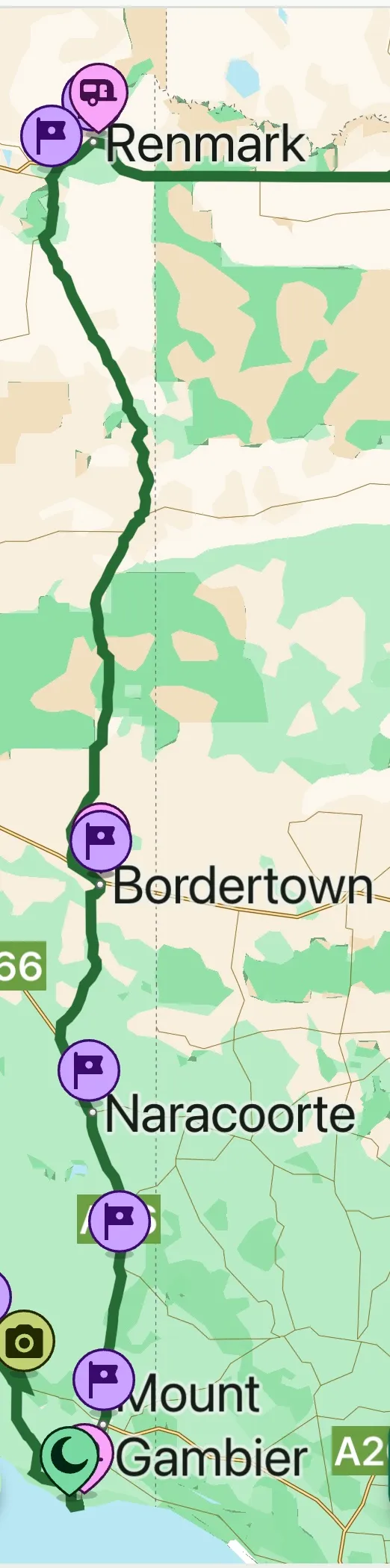
Day 11 - 14th Feb
Renmark - Bordertown.
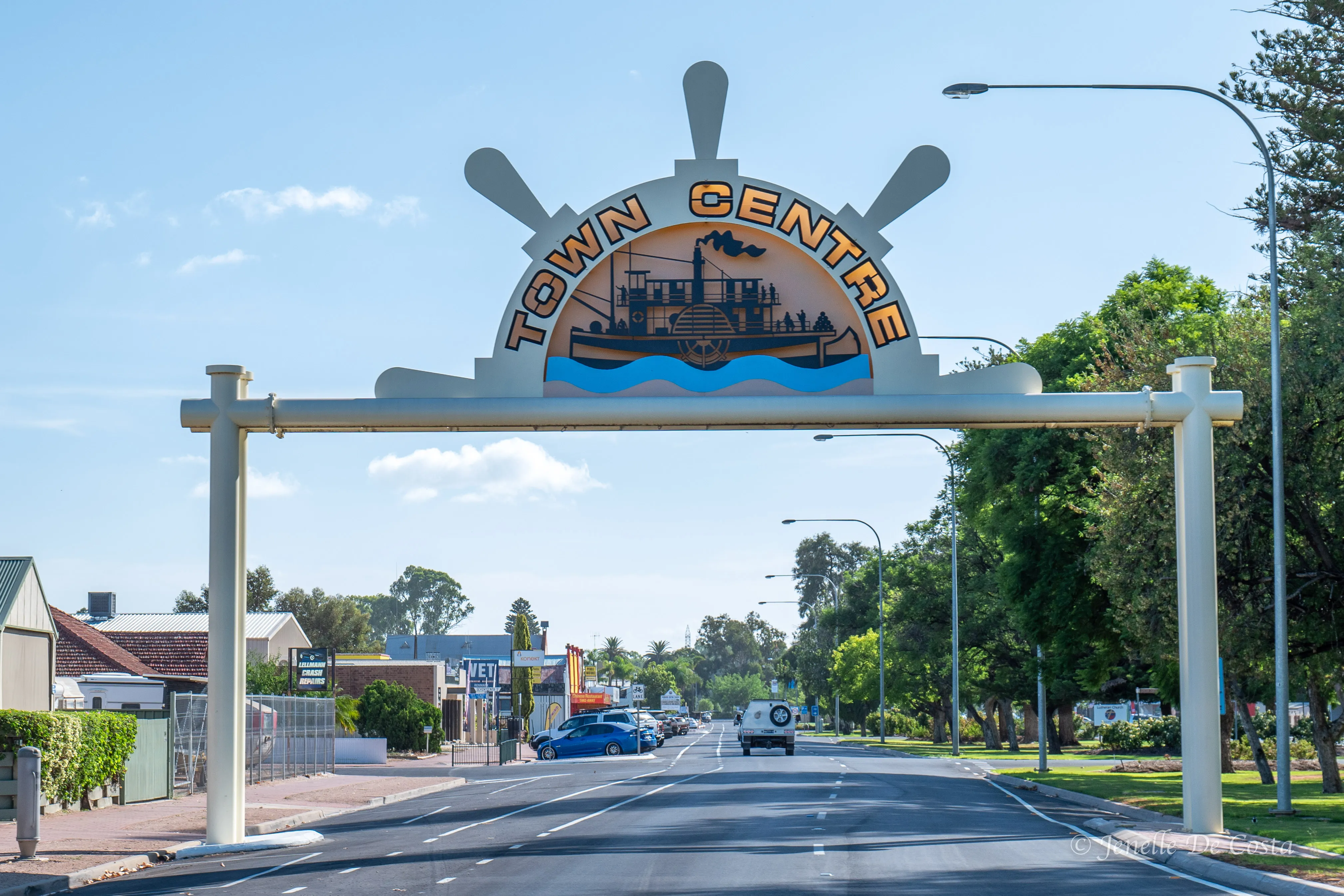
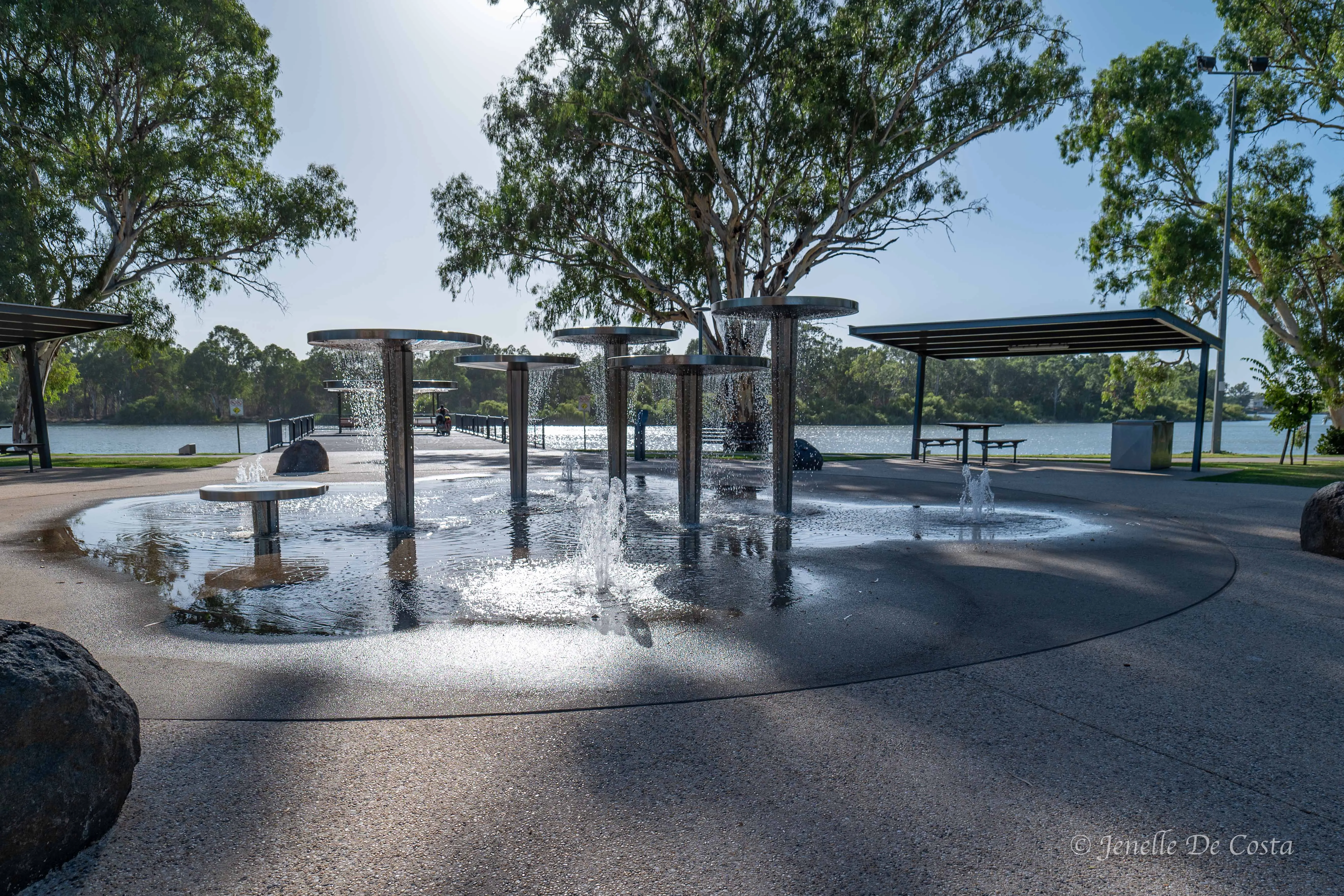
Renmark
Renmark Street Art
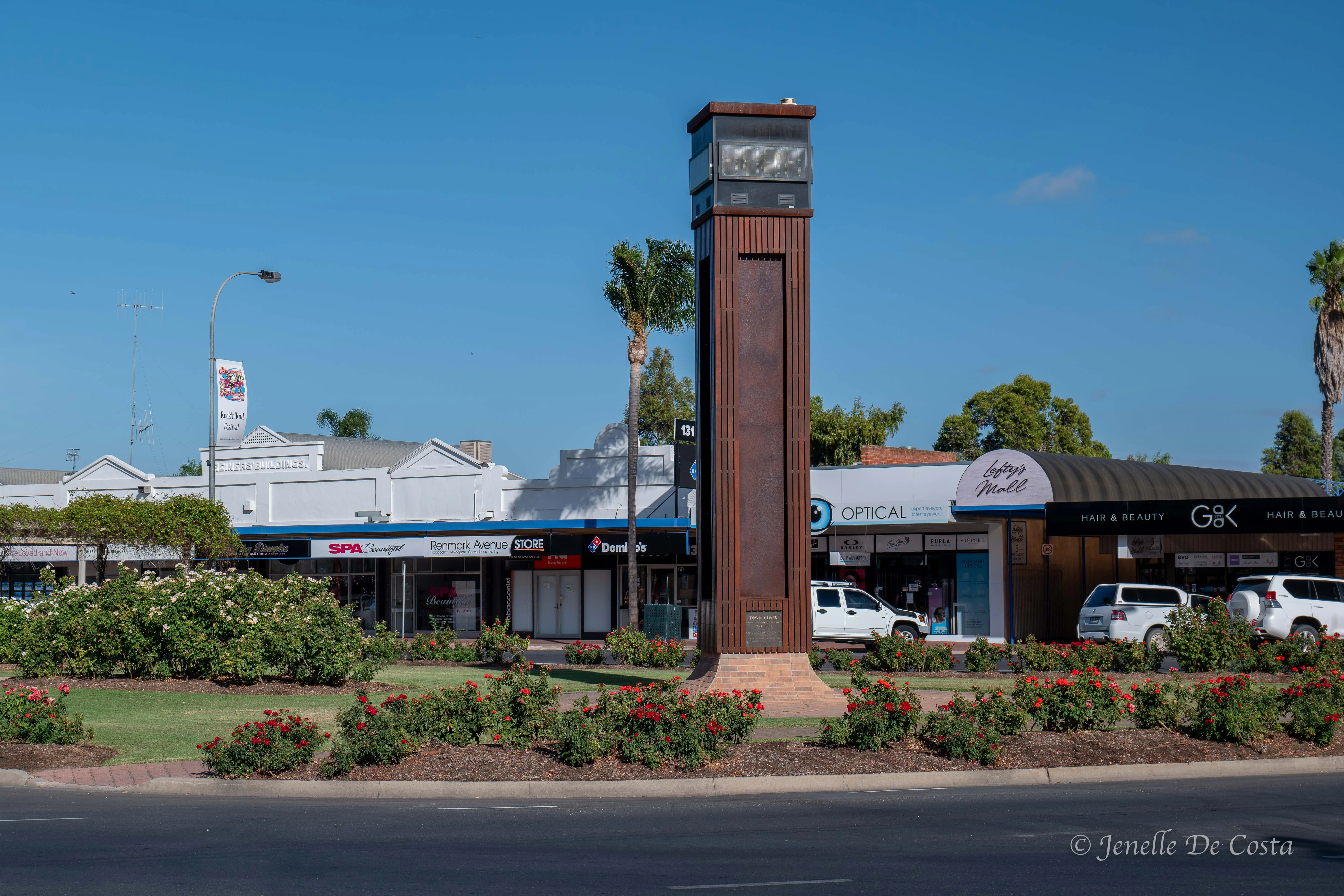
Renmark Streets
Renmark is a huge centre for Water Sking...
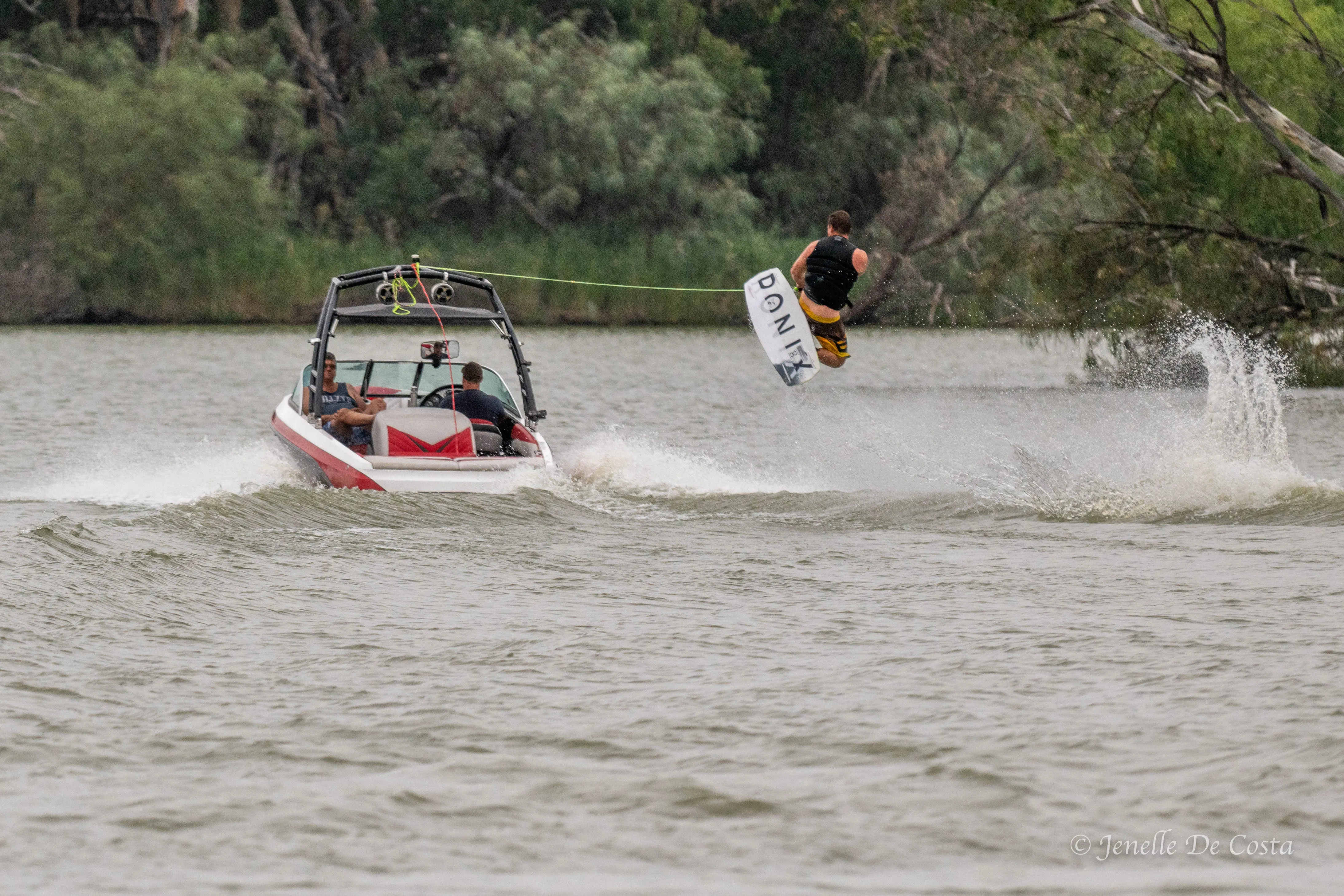
Up and over.
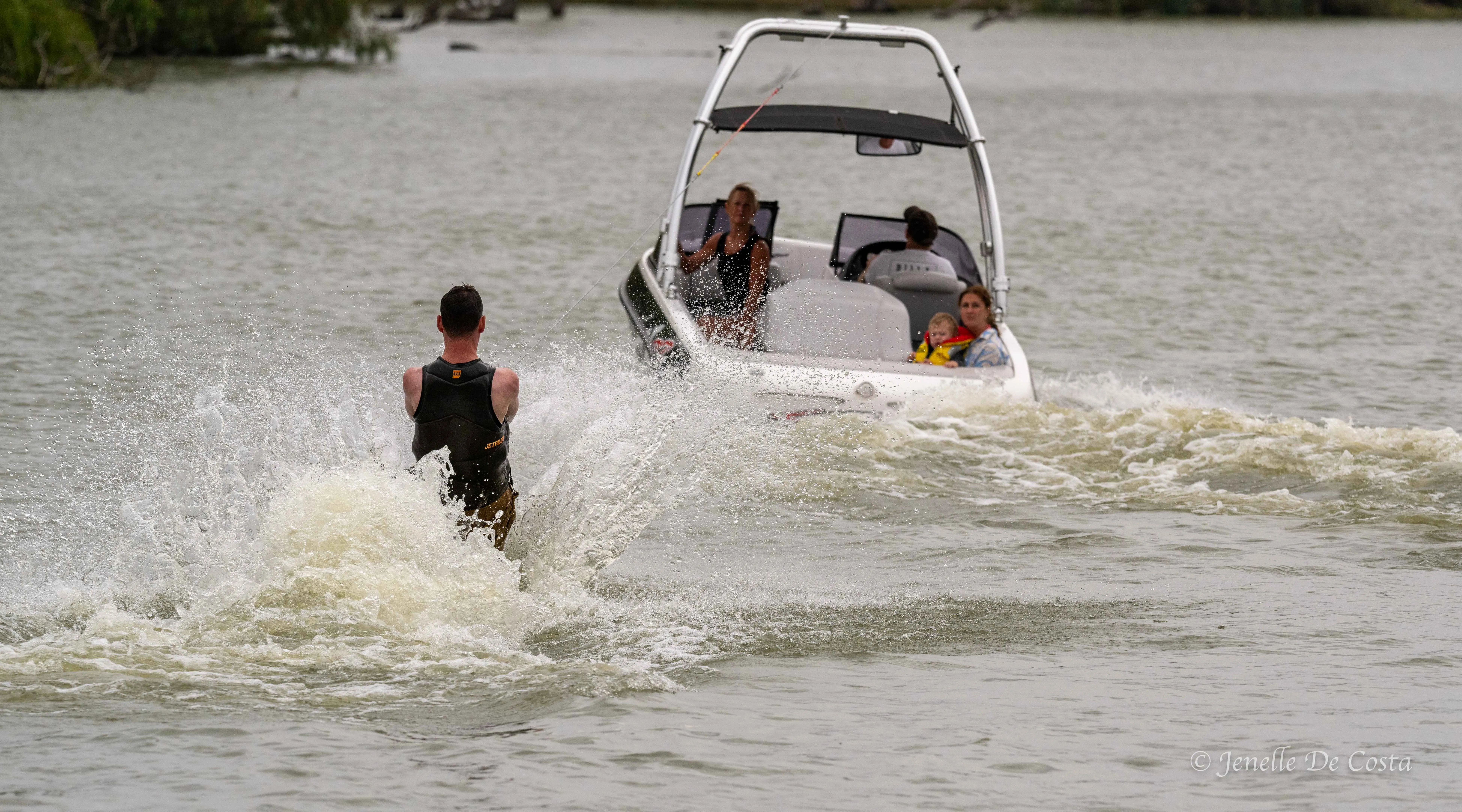
Off we go.
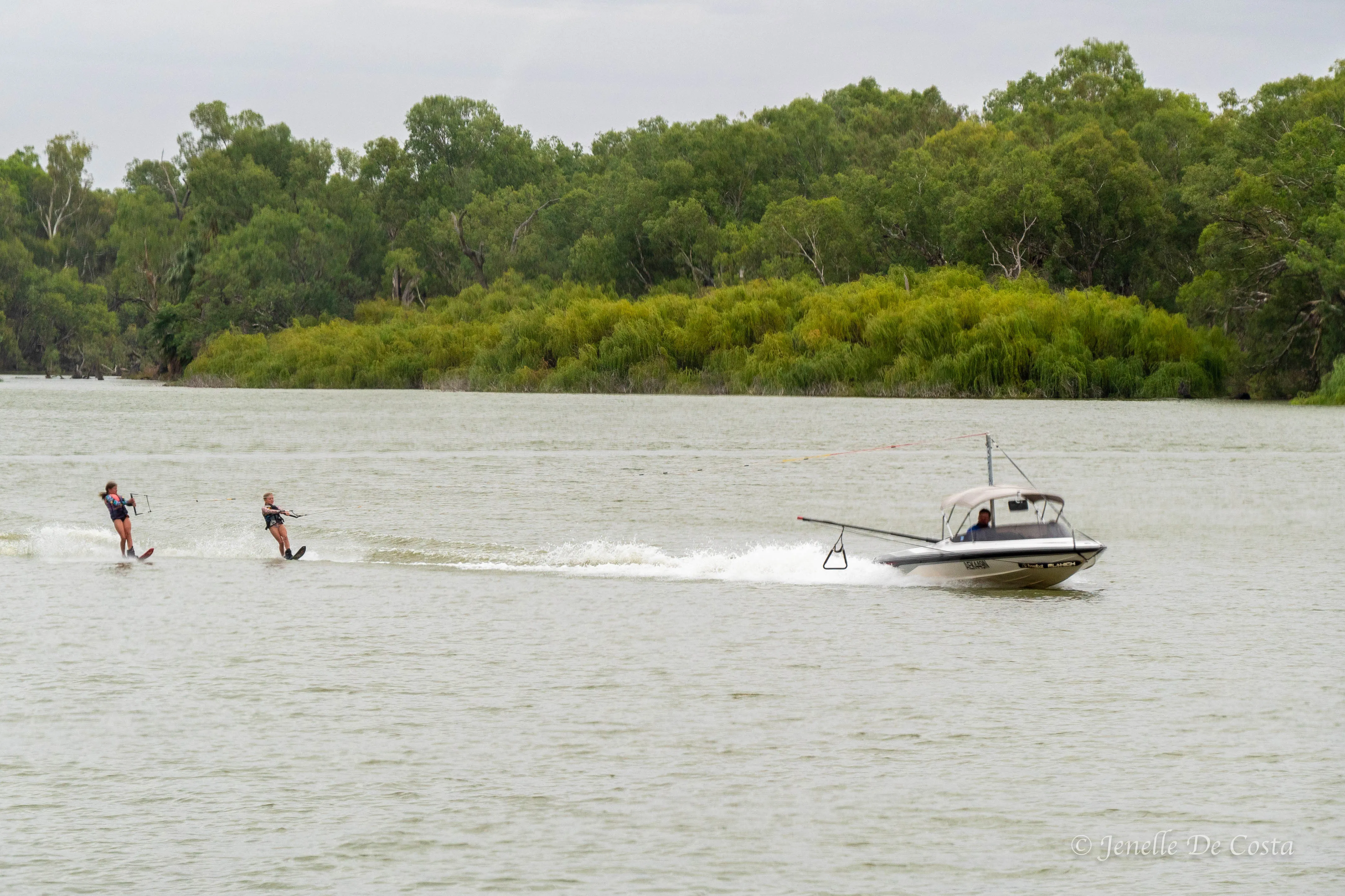
Juniors learning the ropes
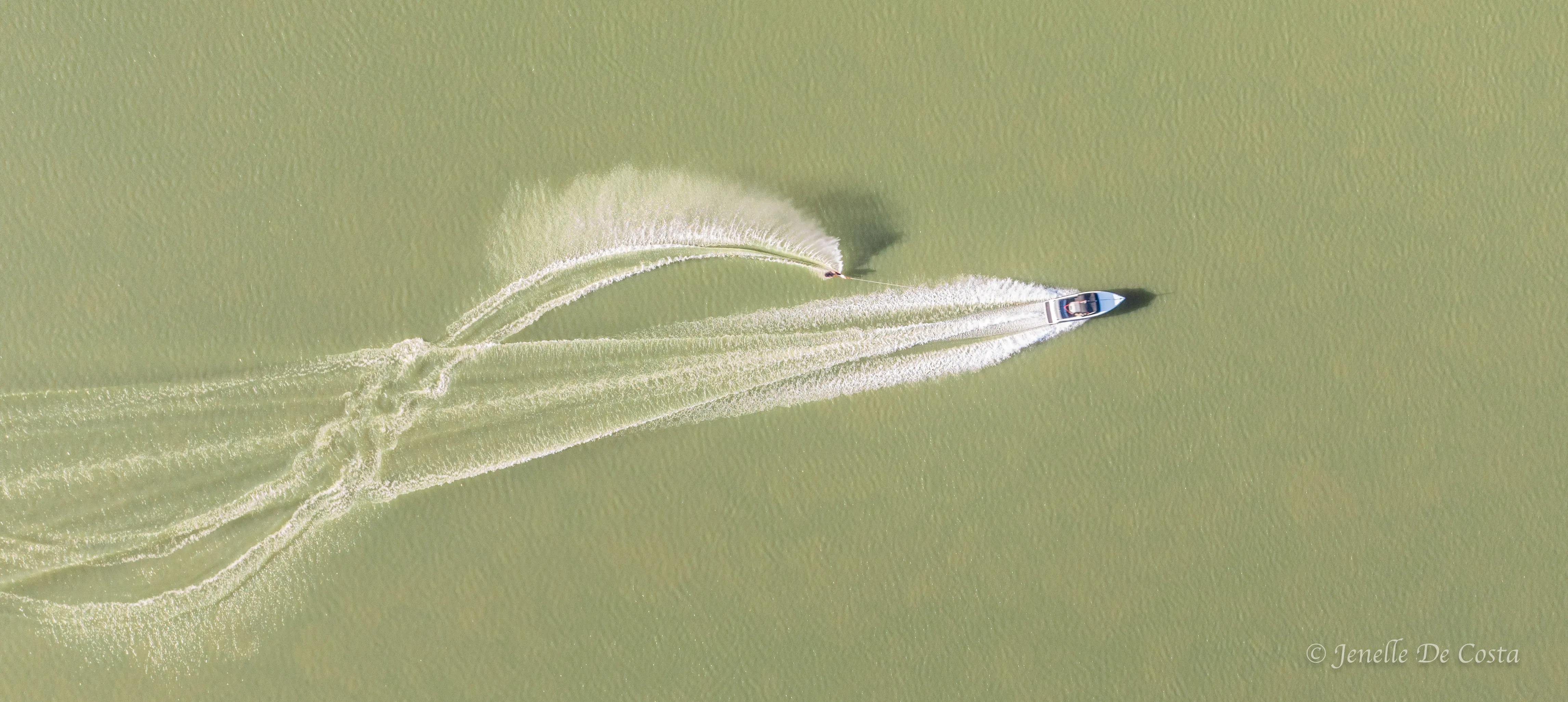
From above
It is also a big house boat area...
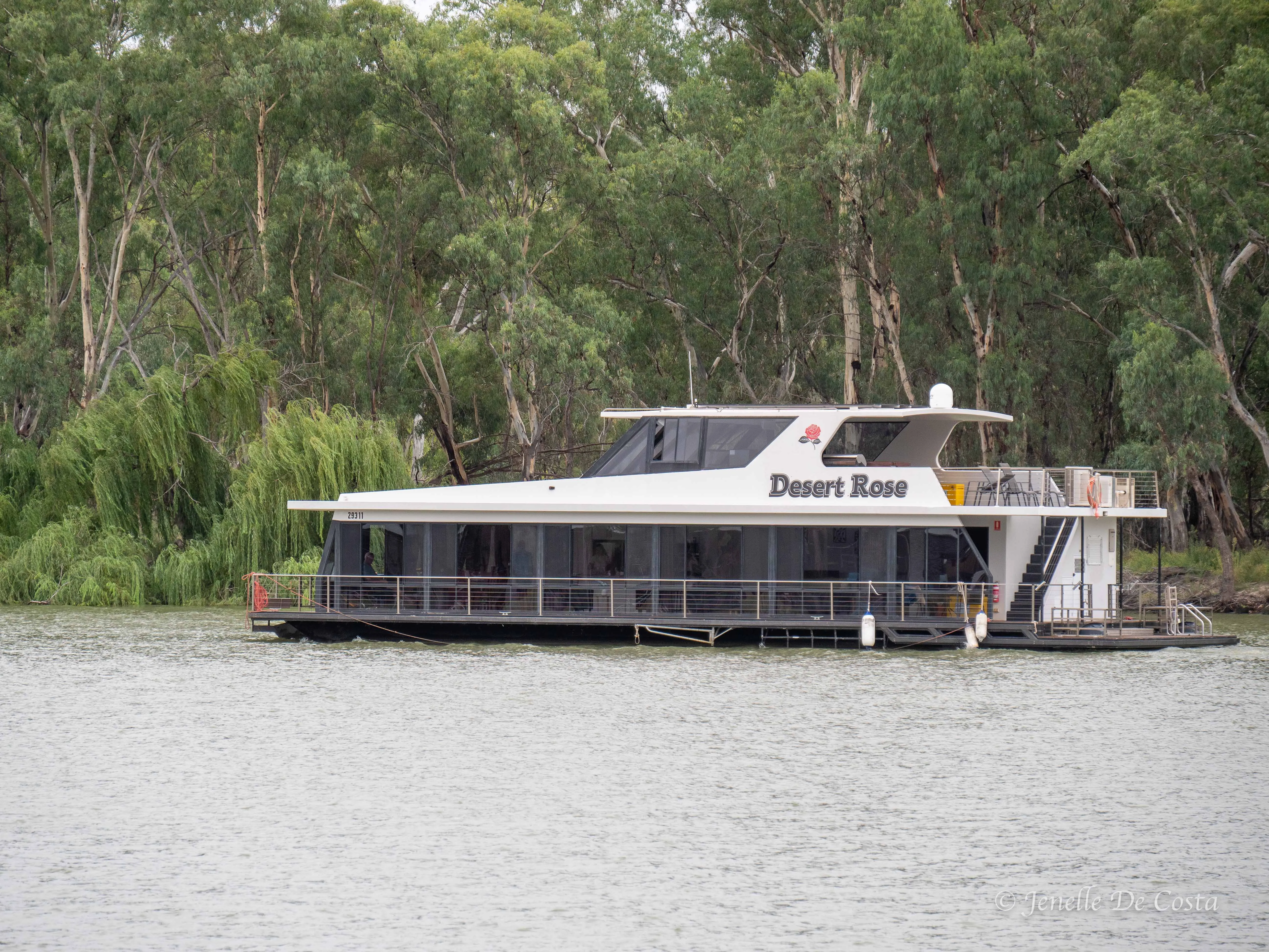
Houseboat Hotel
Many old relics of the past...
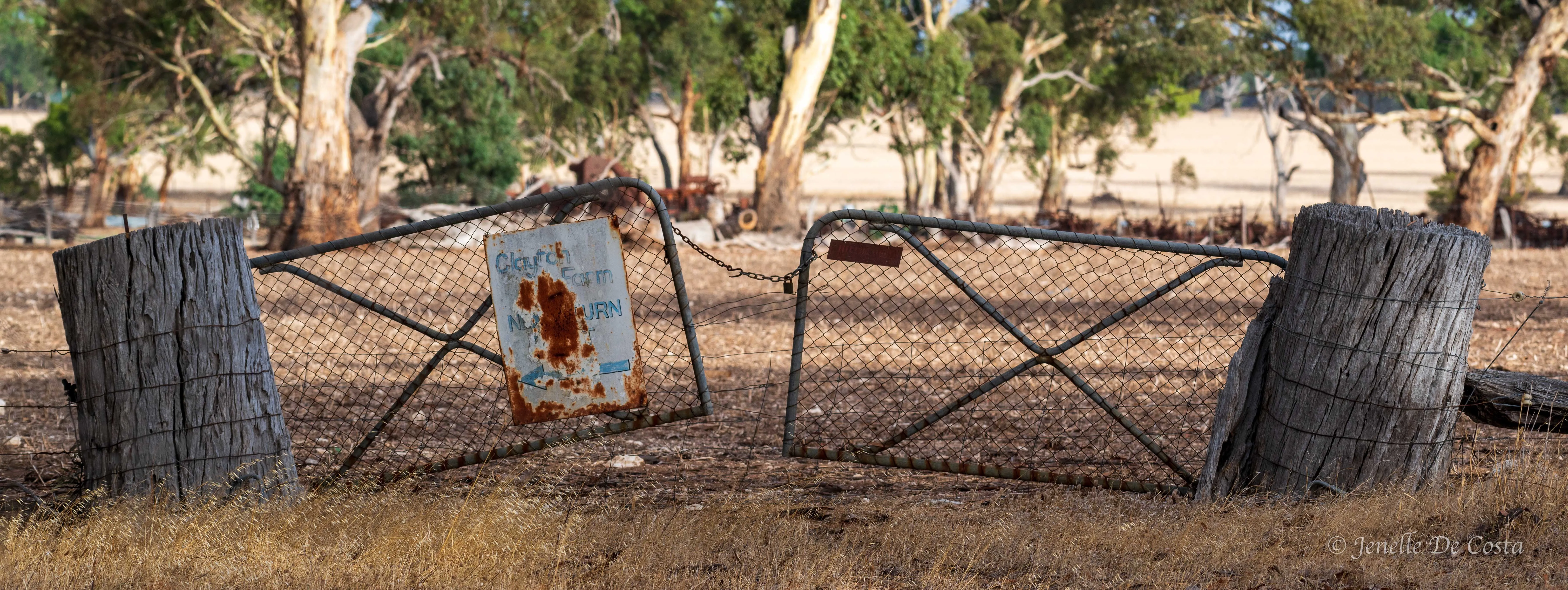
Old farm gate with massive posts.
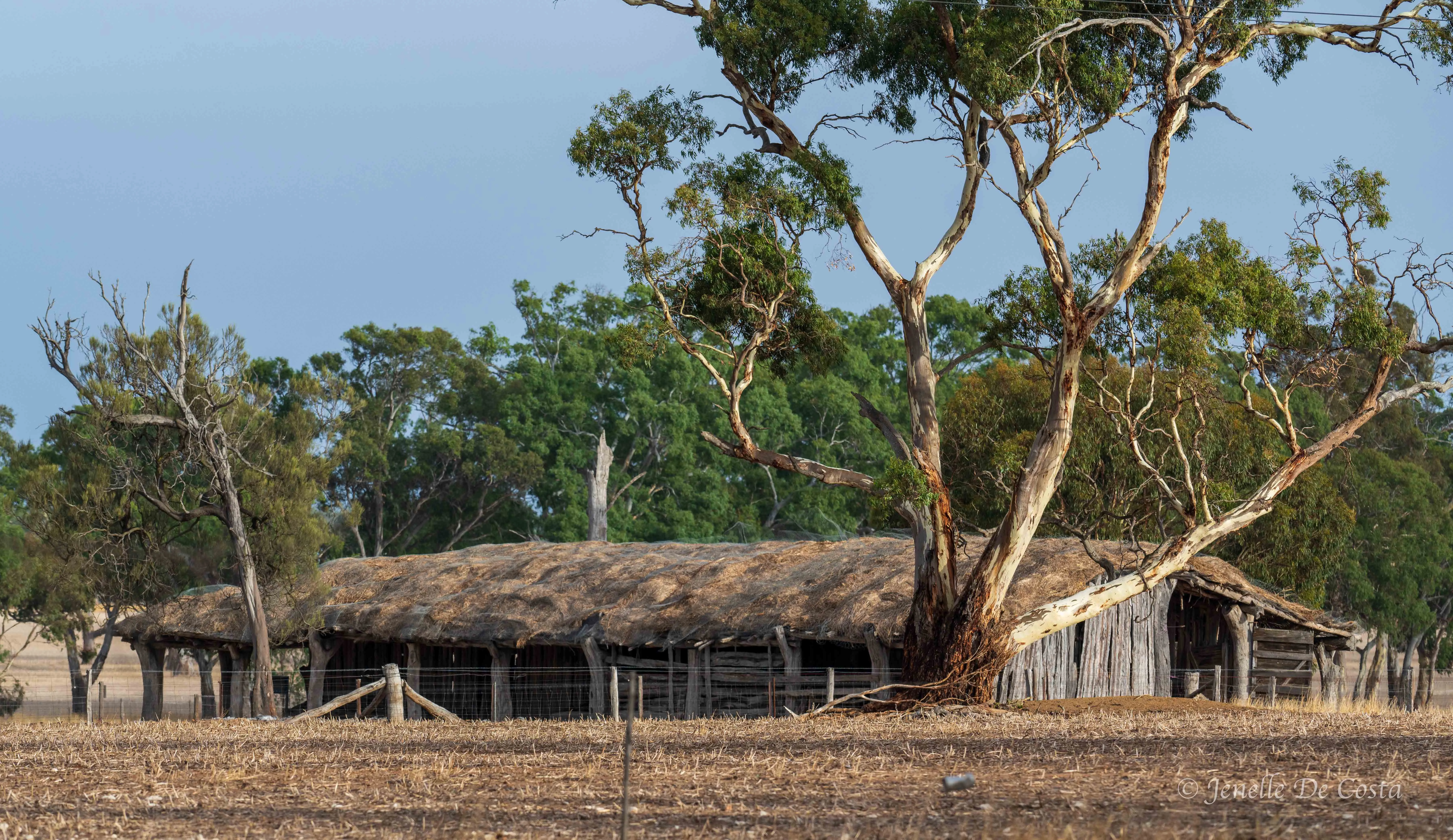
Old slab shed with tatched roof.
Renmark is the heart of what is called the Riverland fruit growing region...
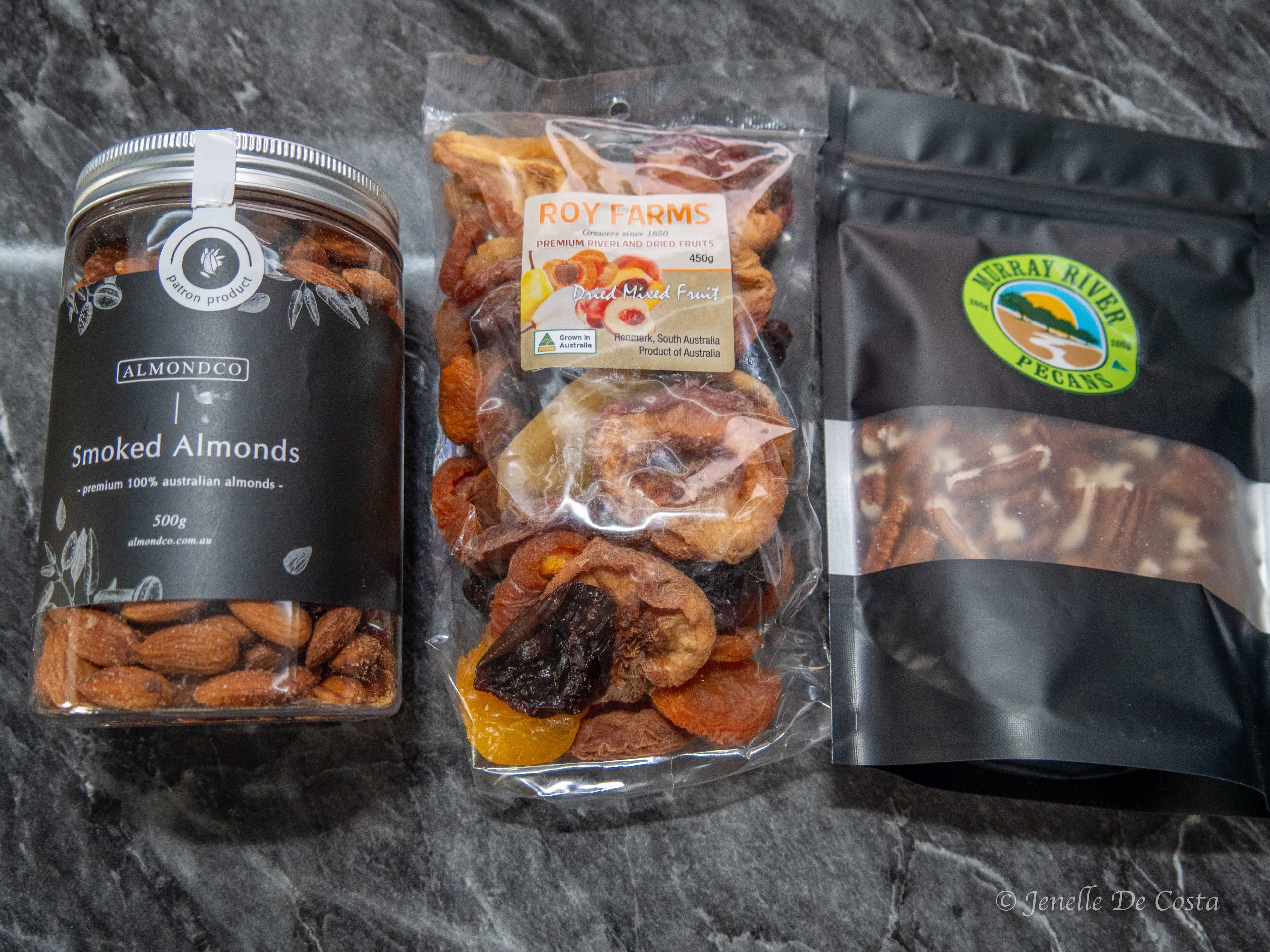
Some of the local produce we bought.
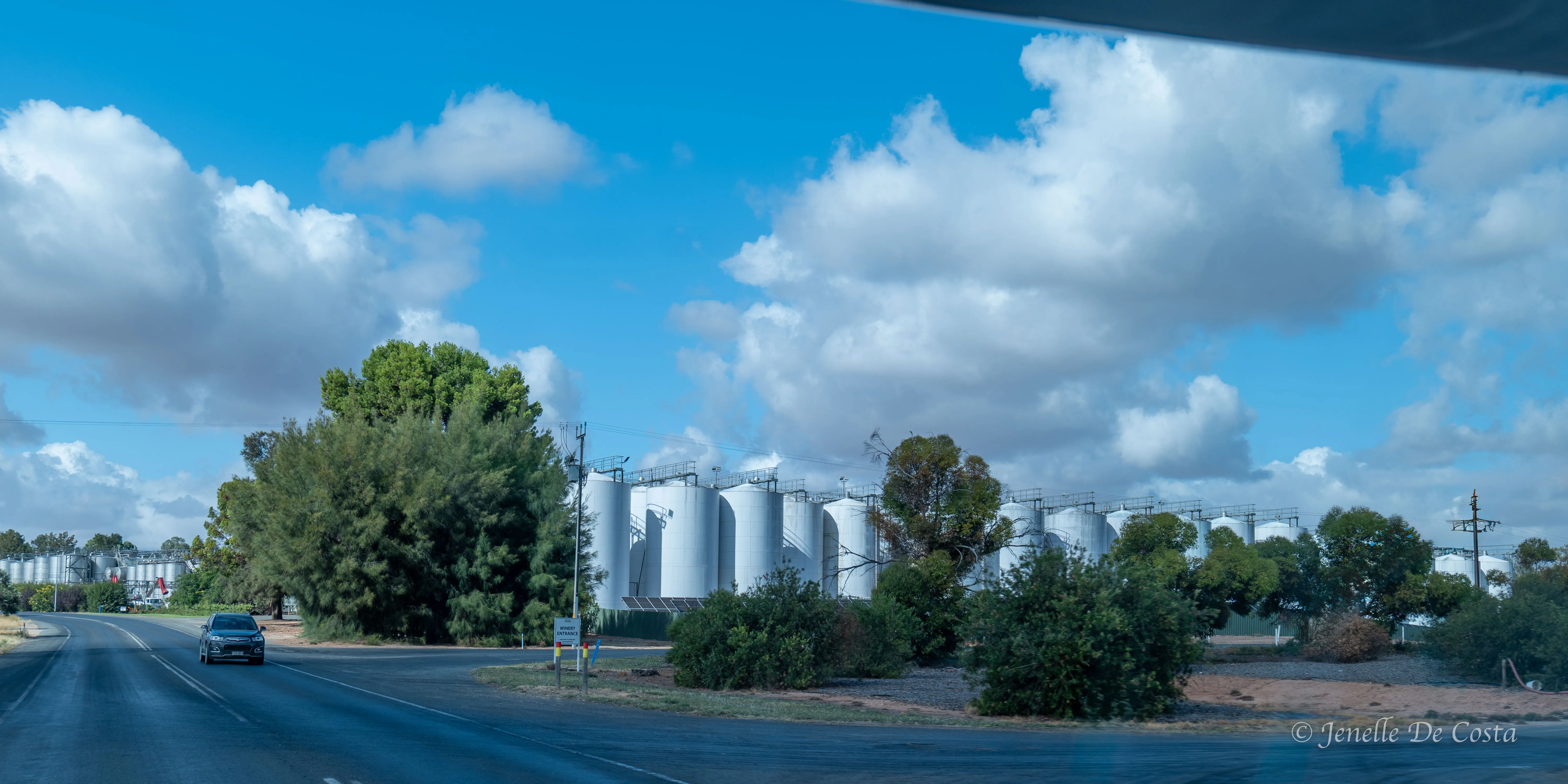
Wine making on an industrial scale. How many bottles per vat/tank?
More of the cliffs that form the Murray River banks. This time at a place called Headings.
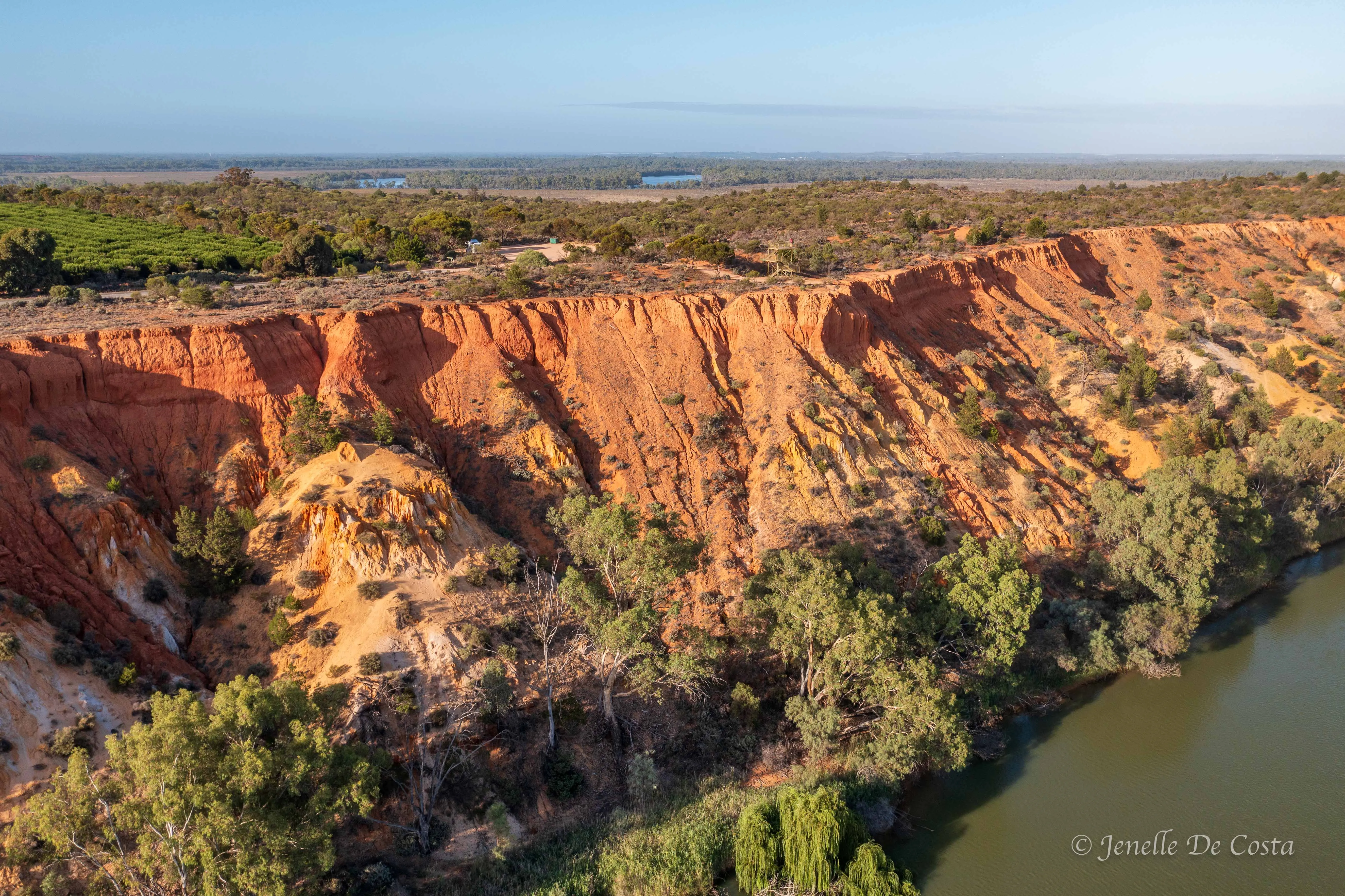
Headings_Cliffs
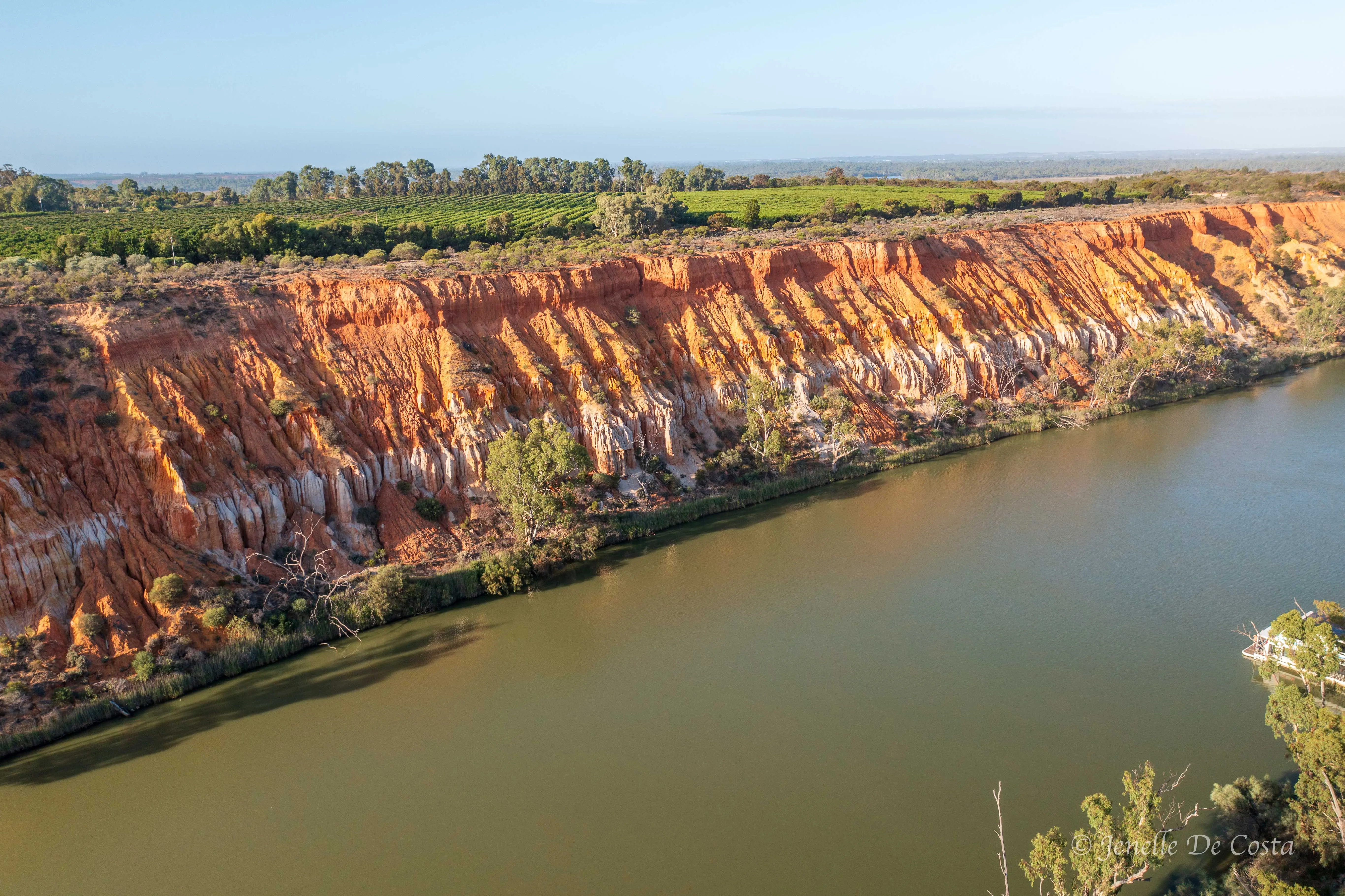
Headings_Cliffs
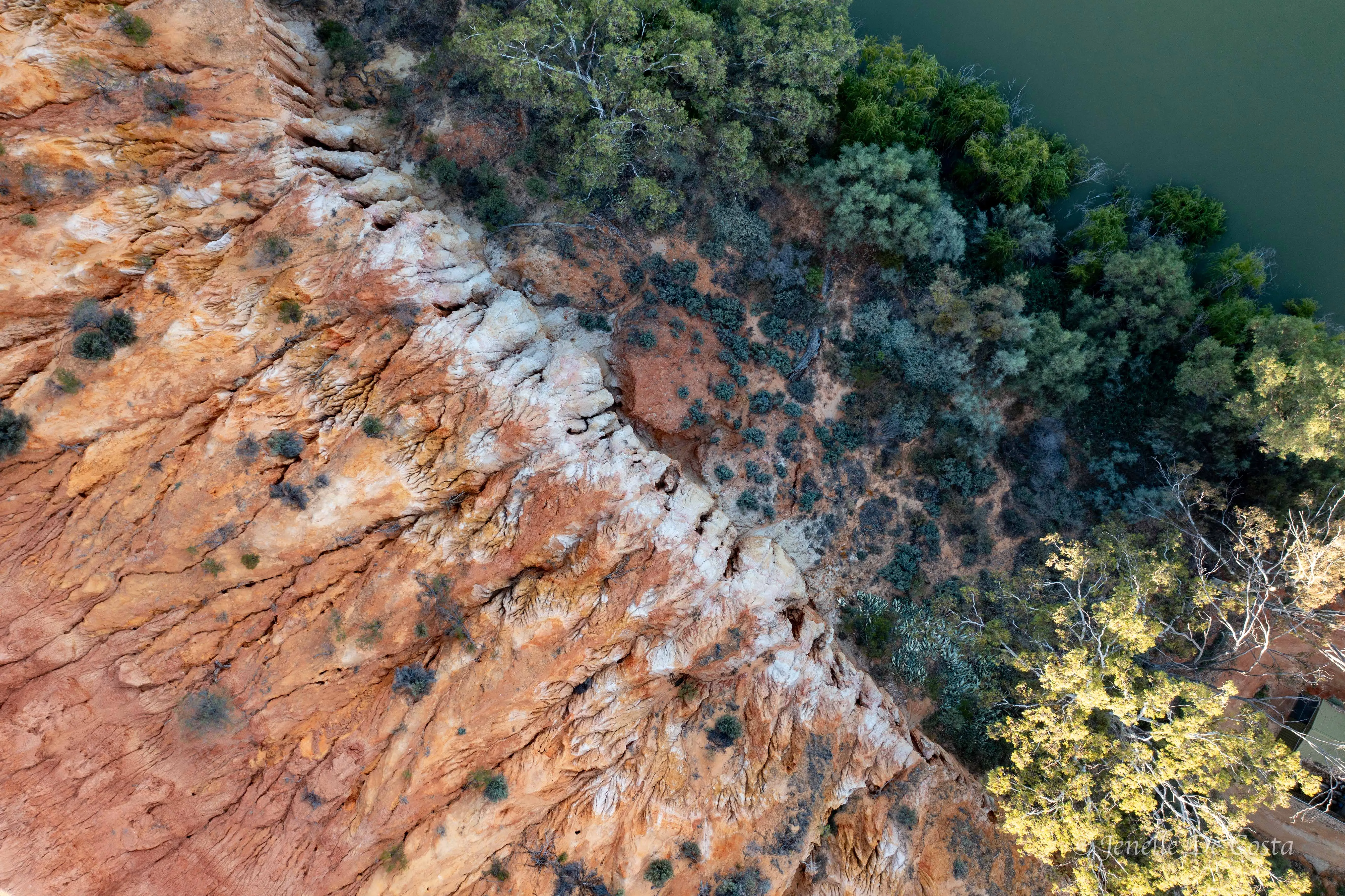
Headings_Cliffs

Headings_Cliffs
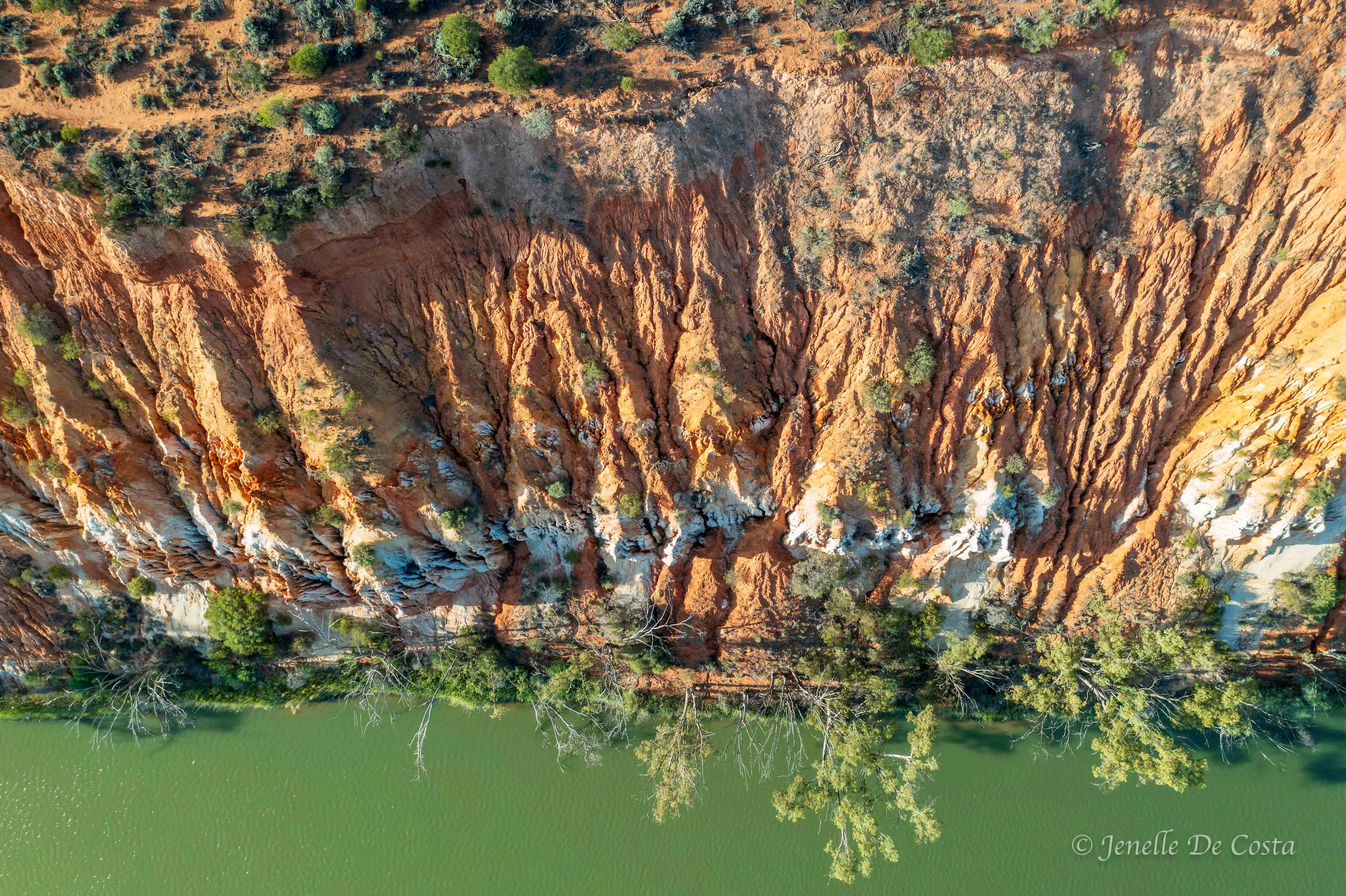
Headings_Cliffs
Birds species photographed in the Renmark area...
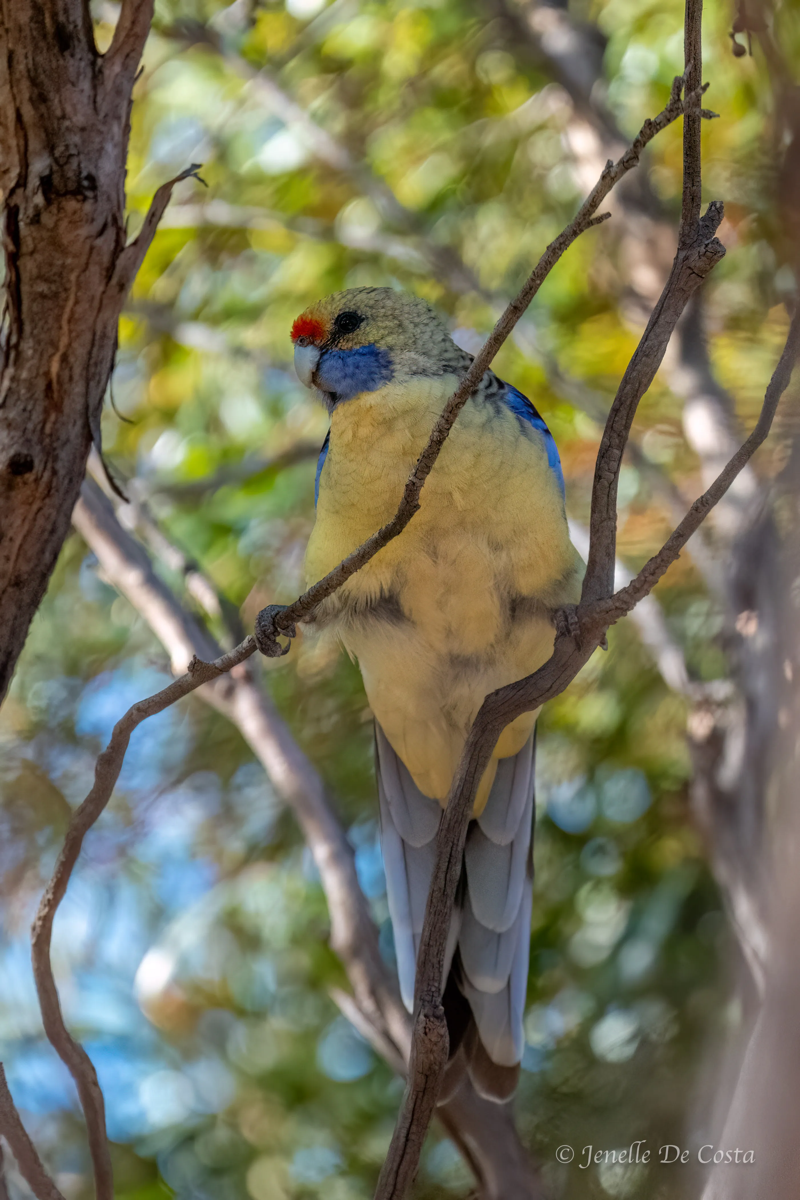
Yellow_Crimson_Rosella
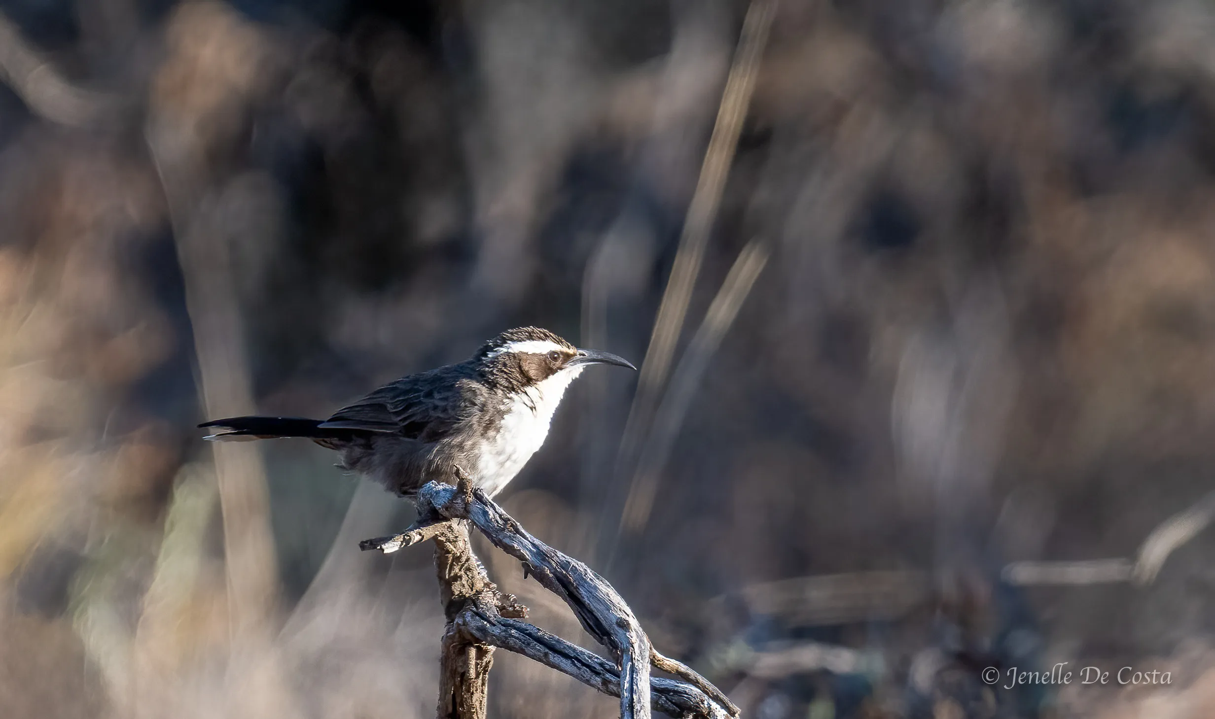
White_Browed_Babbler
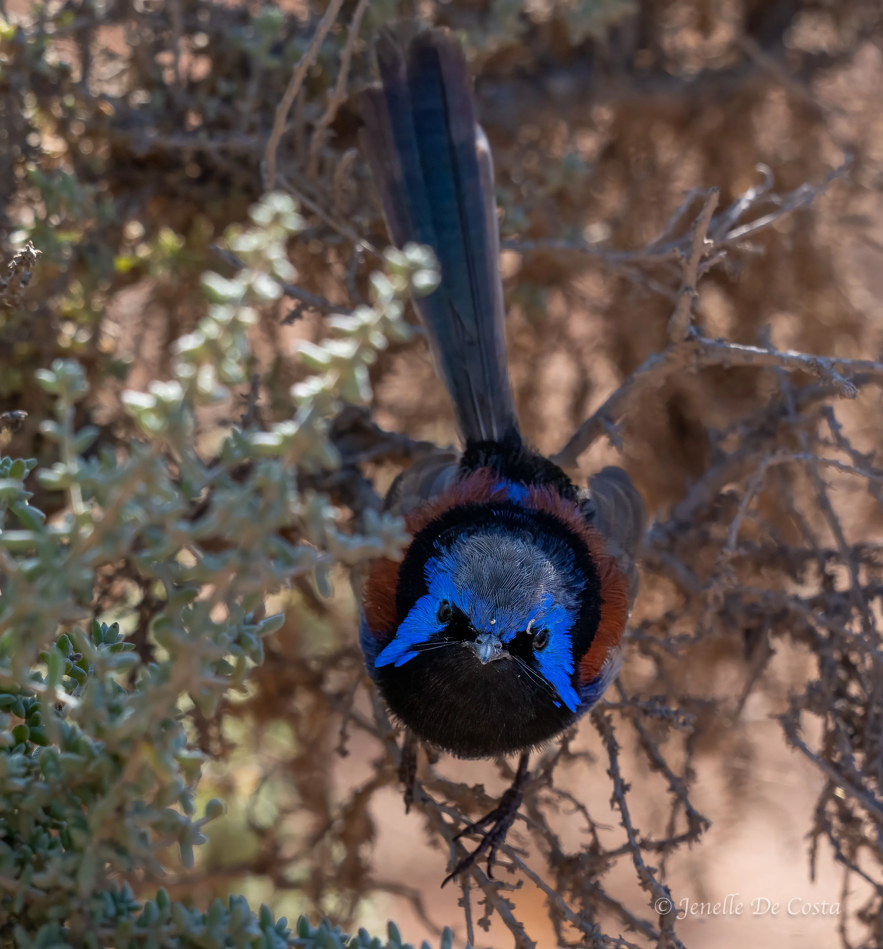
Purple_Backed_Fairy_Wren
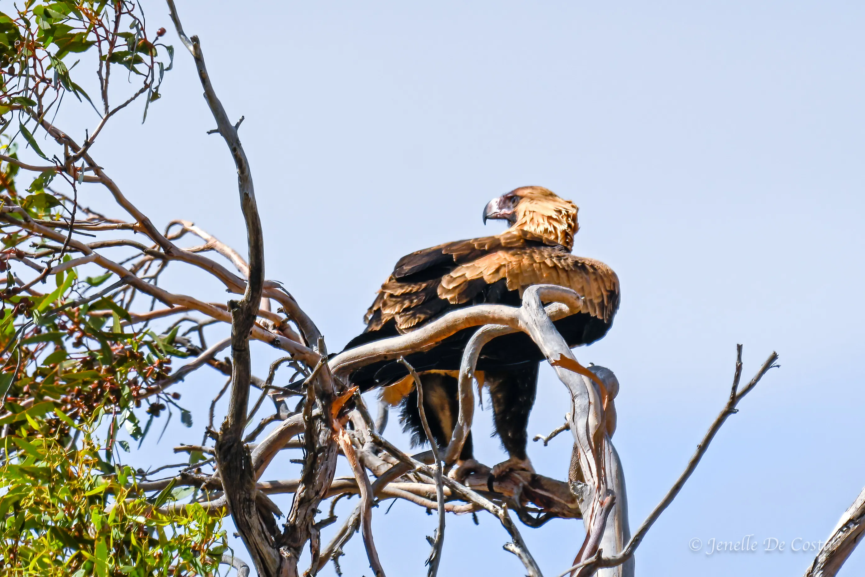
Wedged_Tail_Eagle
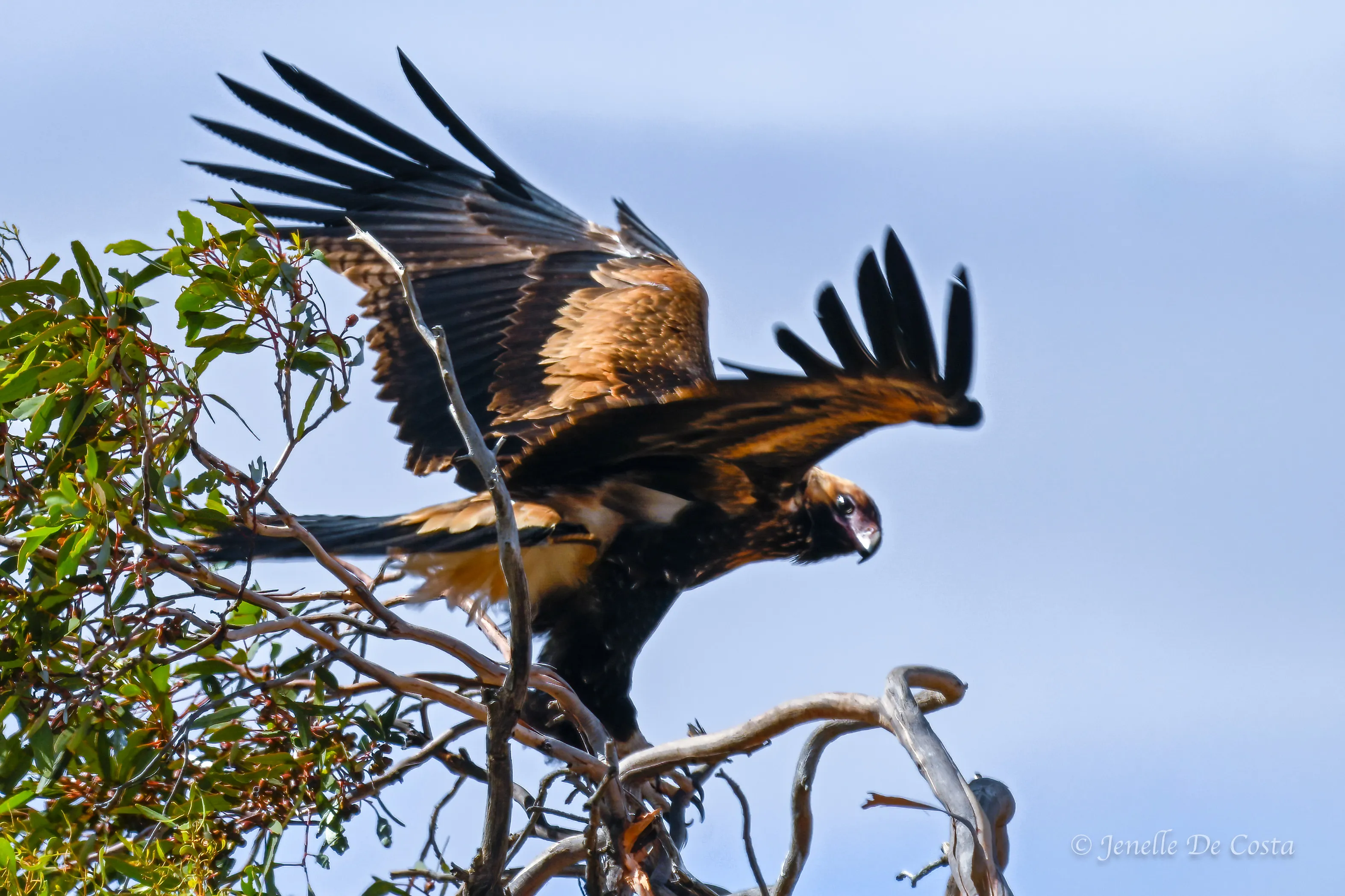
Wedged_Tail_Eagle
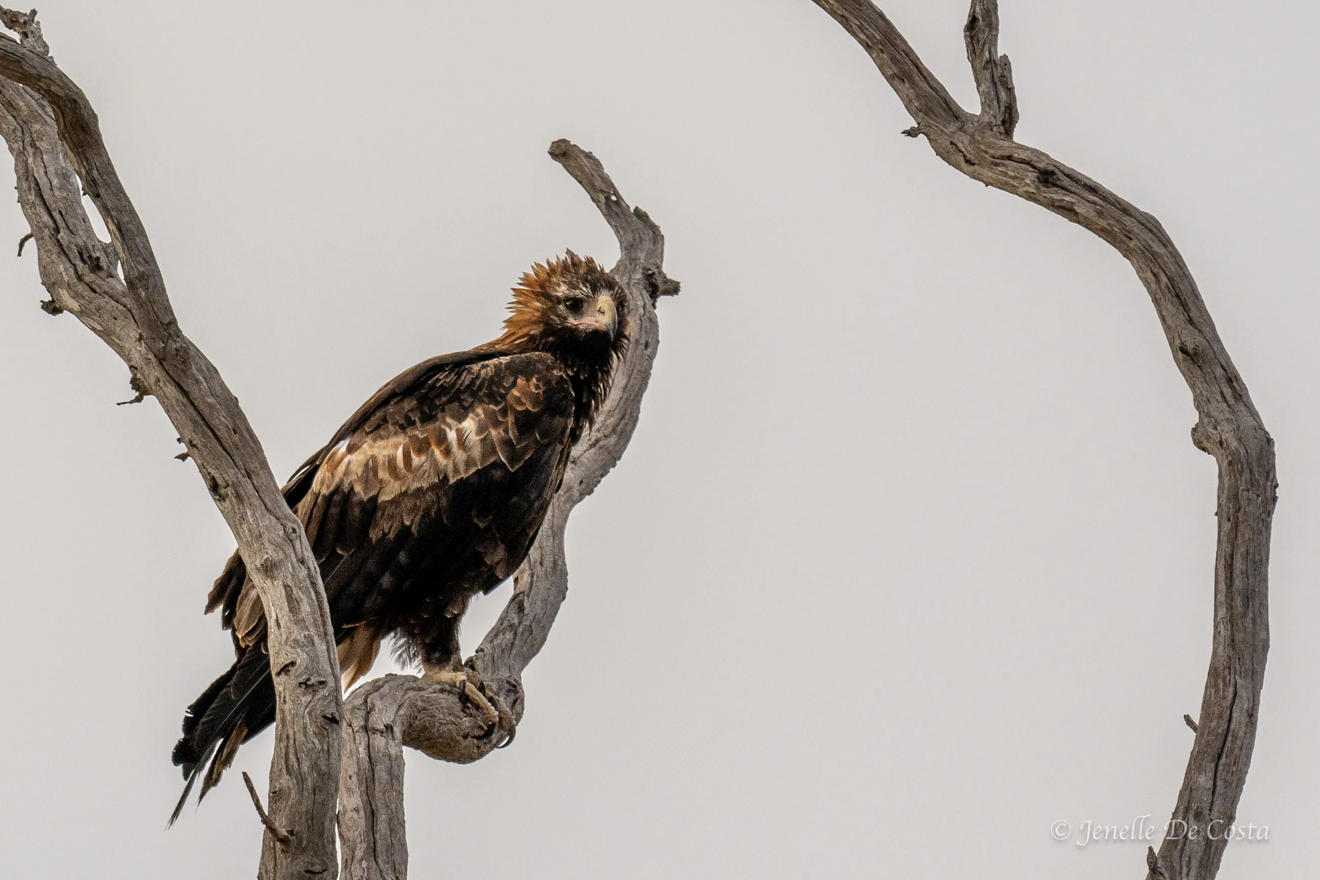
Wedged_Tail_Eagle
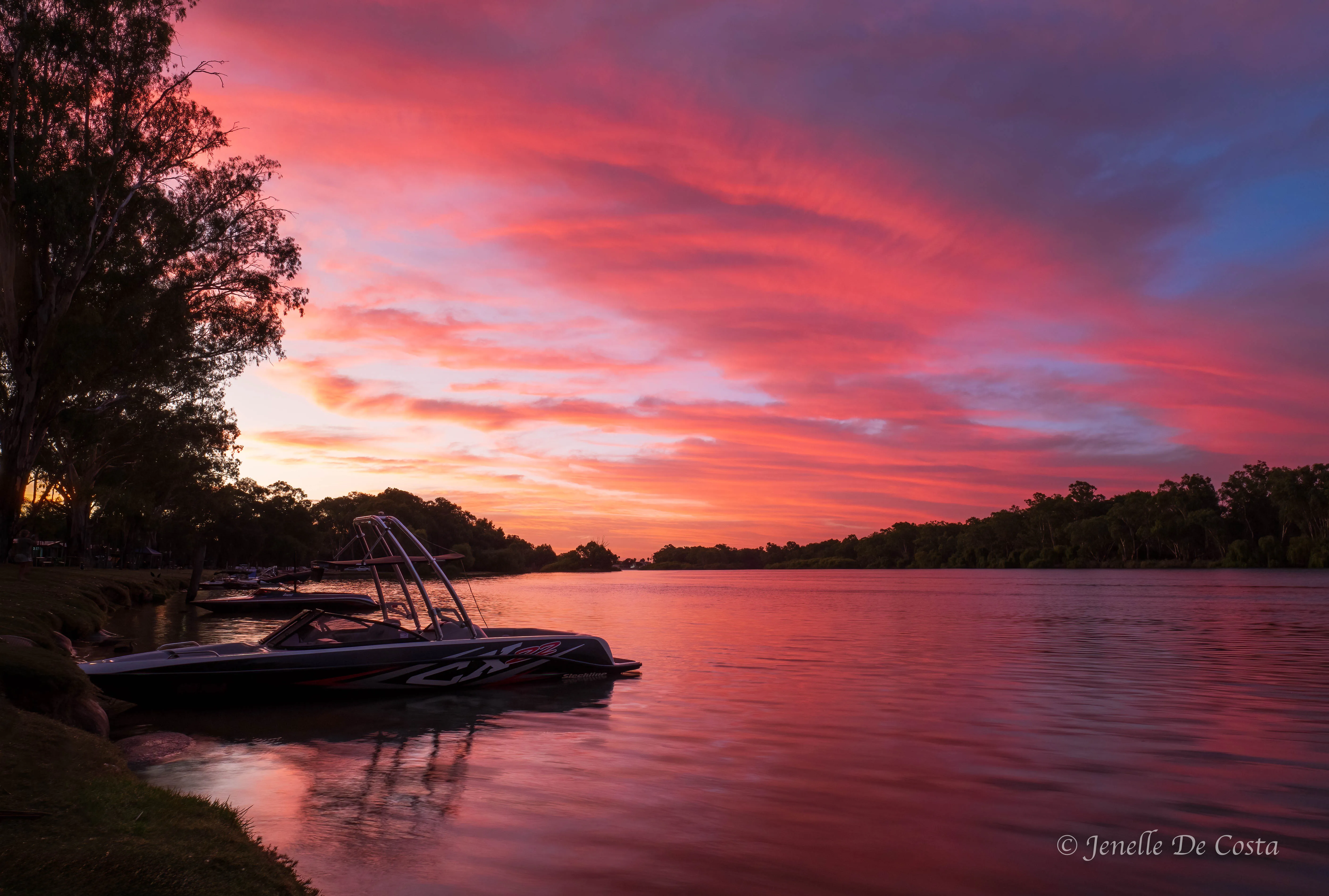
Sunset_Renmark_Caravan Park
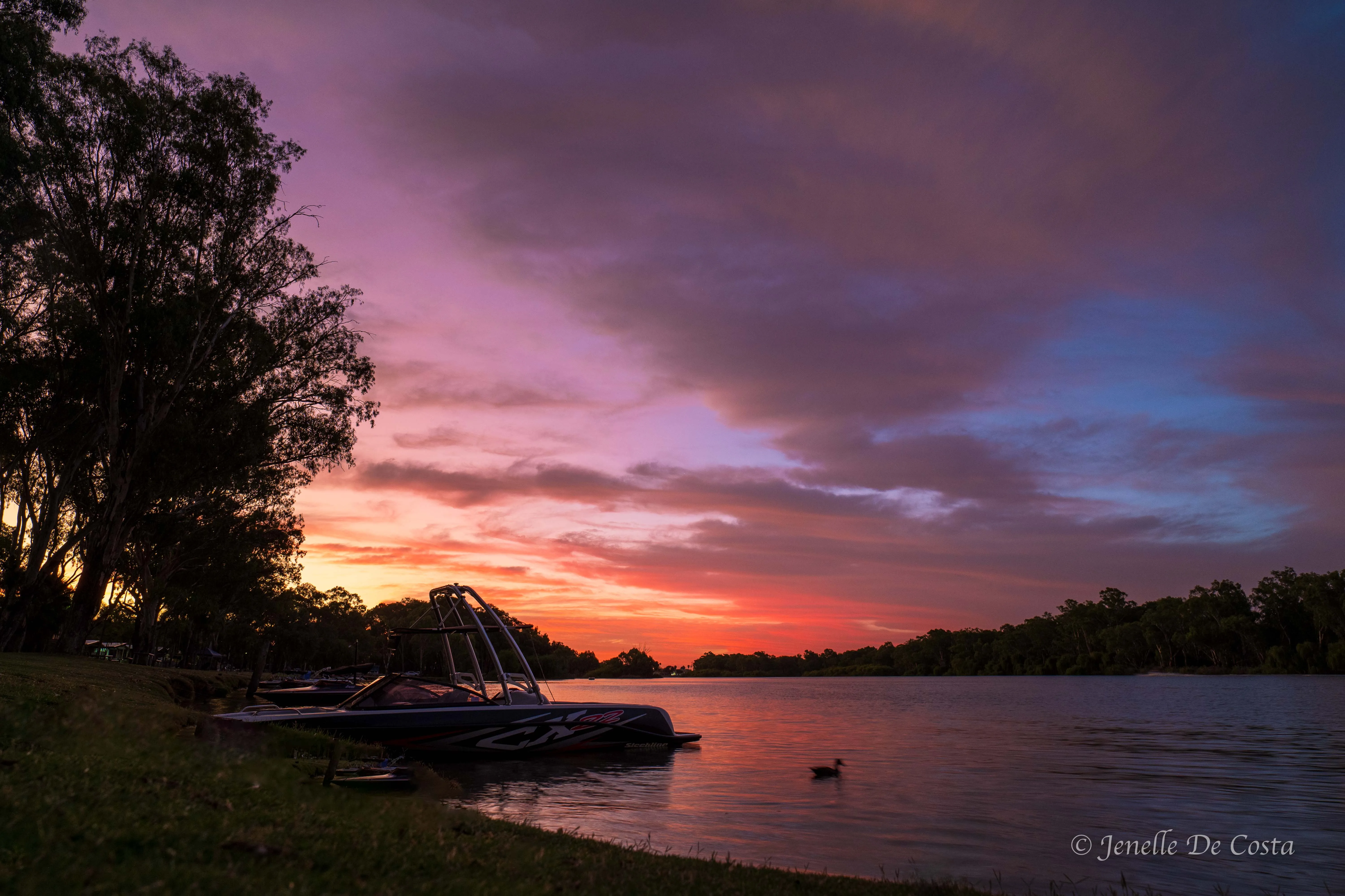
Sunset_Renmark_Caravan Park
South of the Riverlands, on our way to our next overnight stop at Bordertown, we enter the "wide brown land". Cropping from horizon to horizon for hundreds of kilometres...
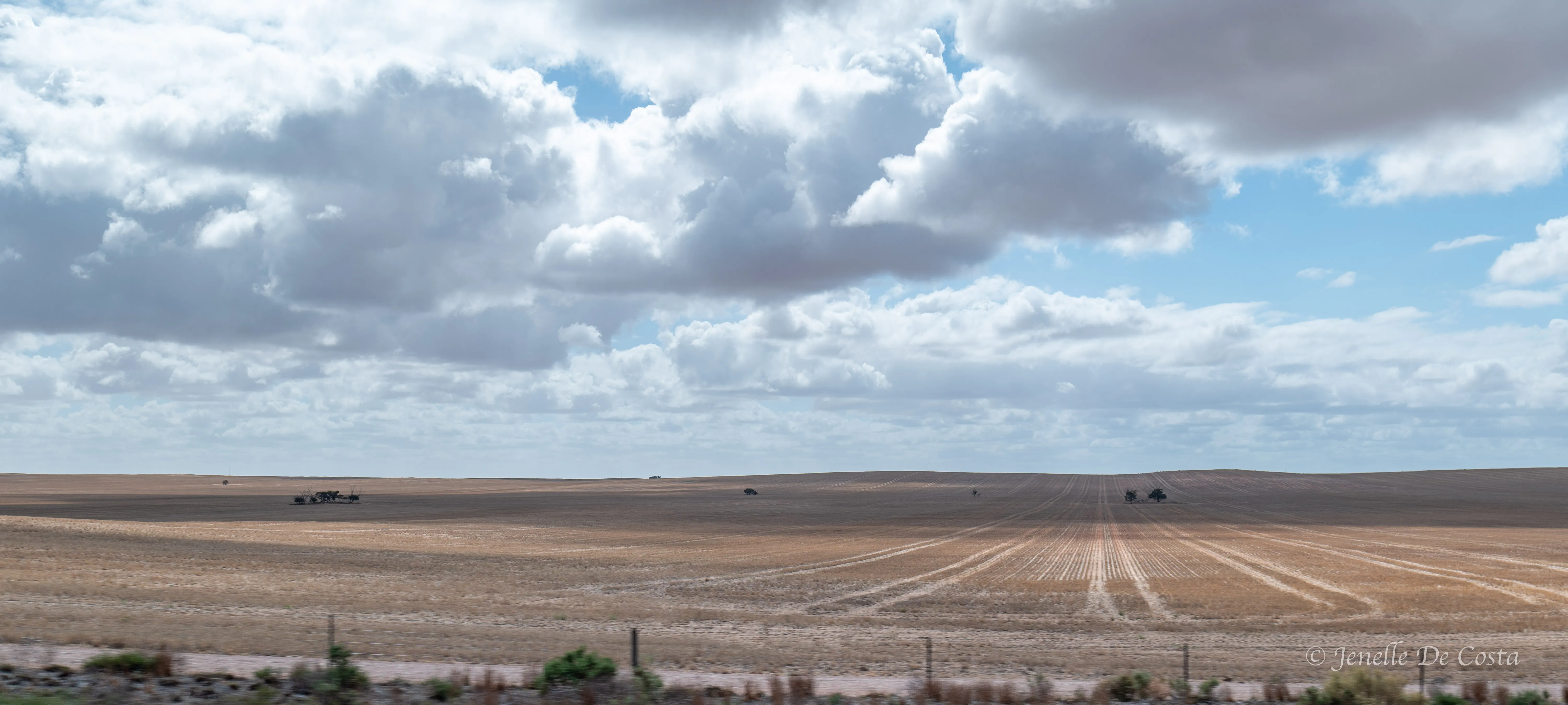
The Wide_Brown_Land
South from Bordertown and onto the World Heritage Listed Naracootre Caves...
Day 12 - 15th Feb
Bordertown - Mt Gambier - Cape Northumberland.
Naracoorte_Caves_Park_Entry
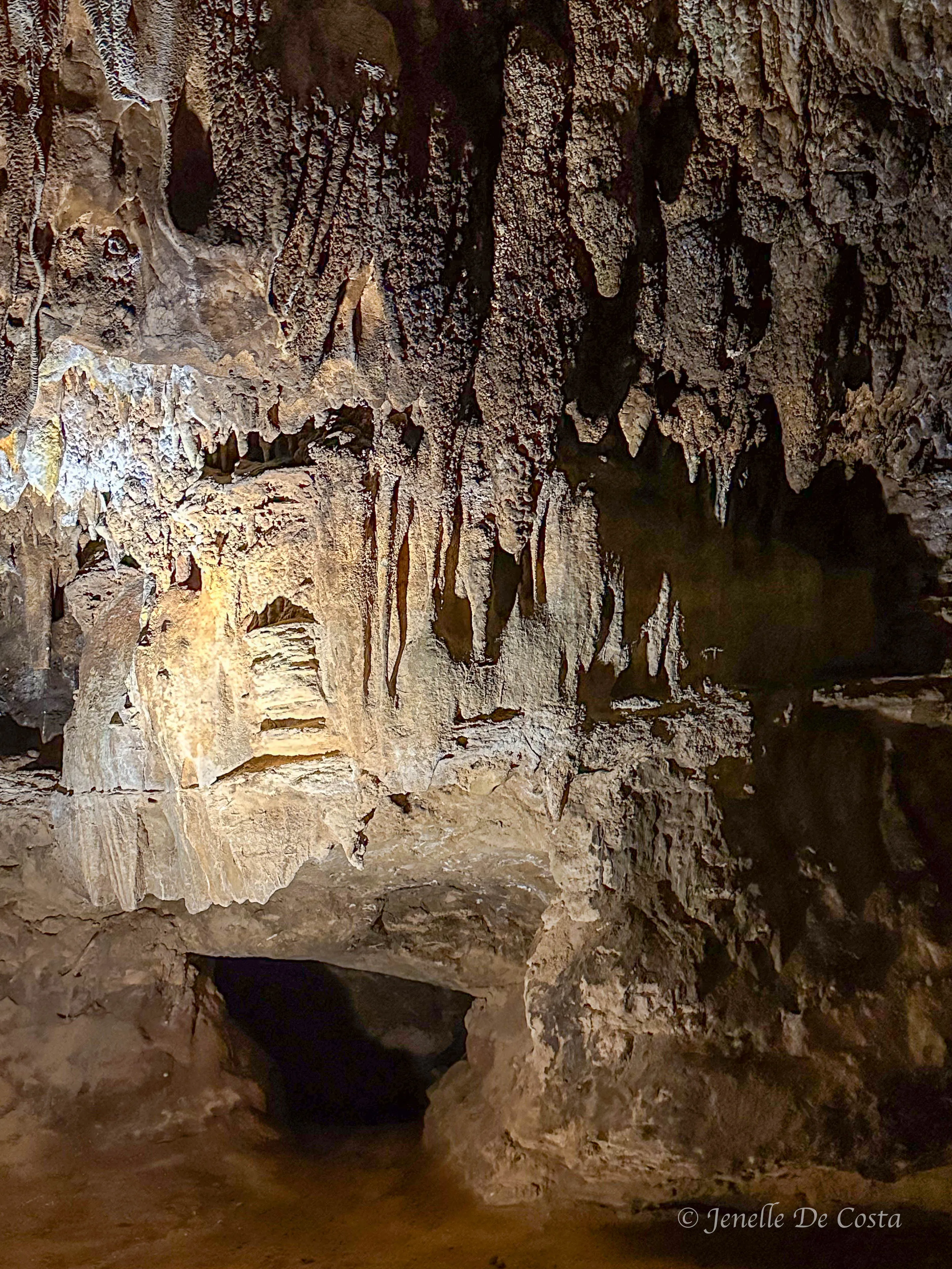
Naracoorte_Caves
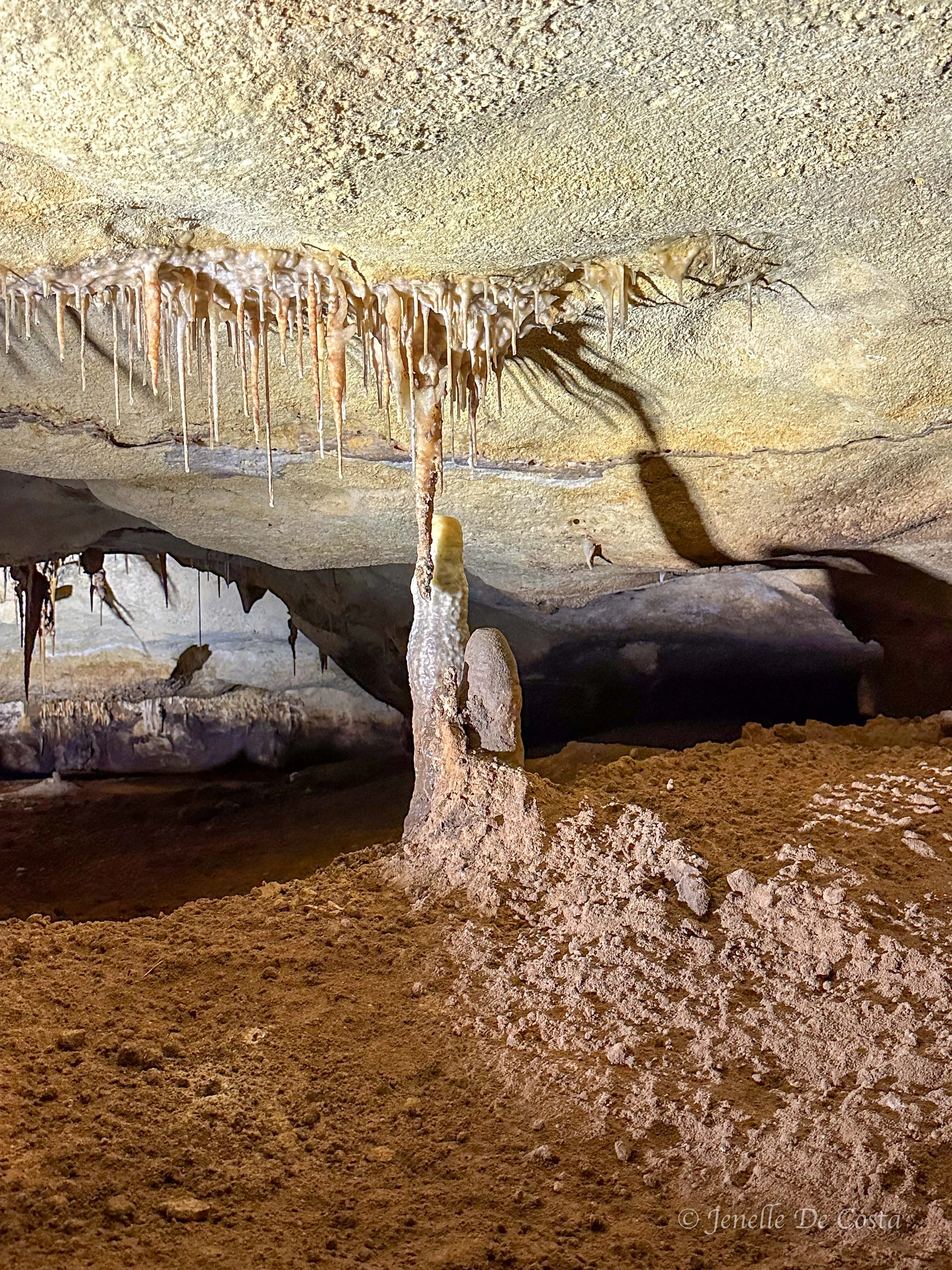
Naracoorte_Caves
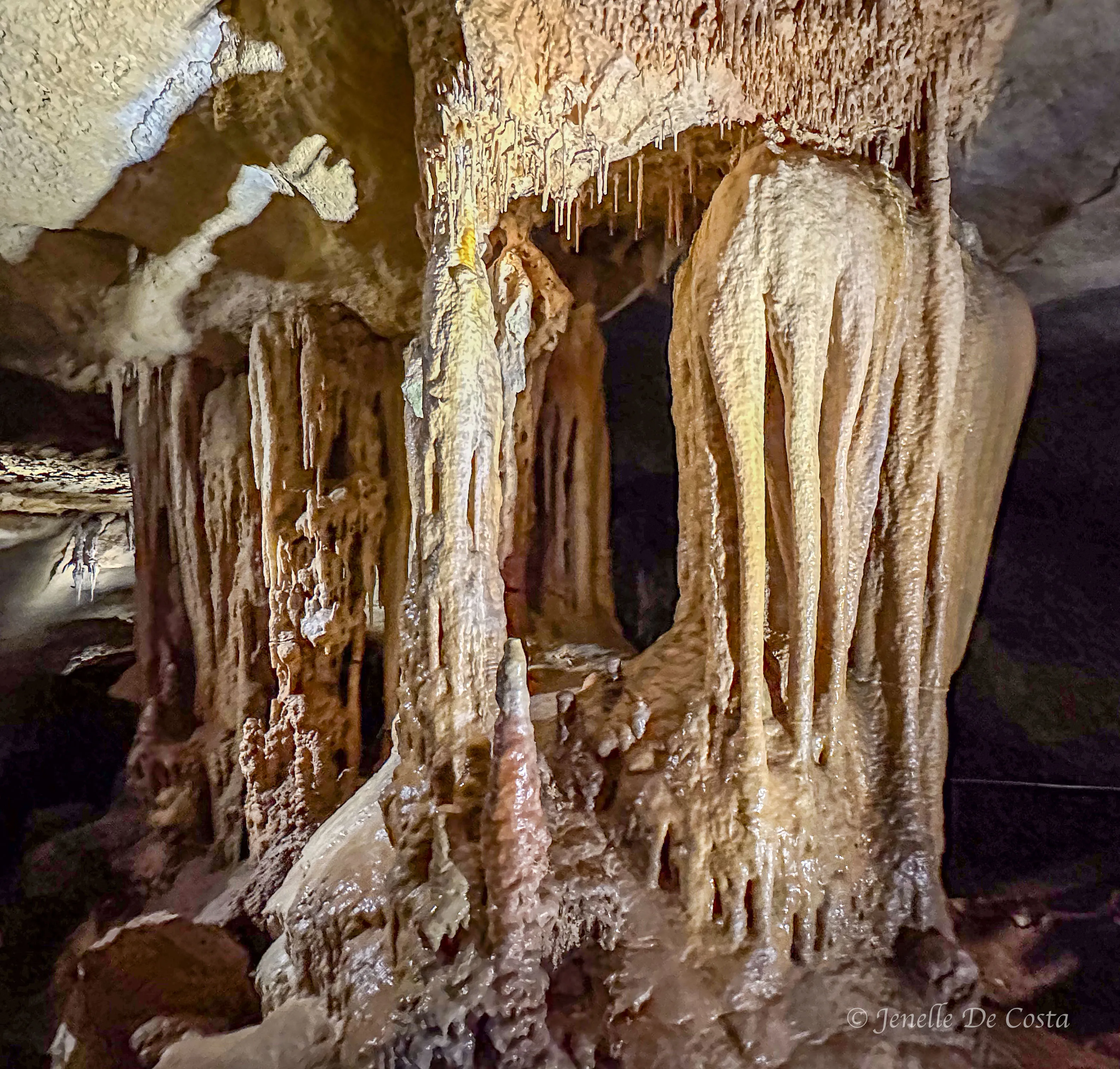
Naracoorte_Caves
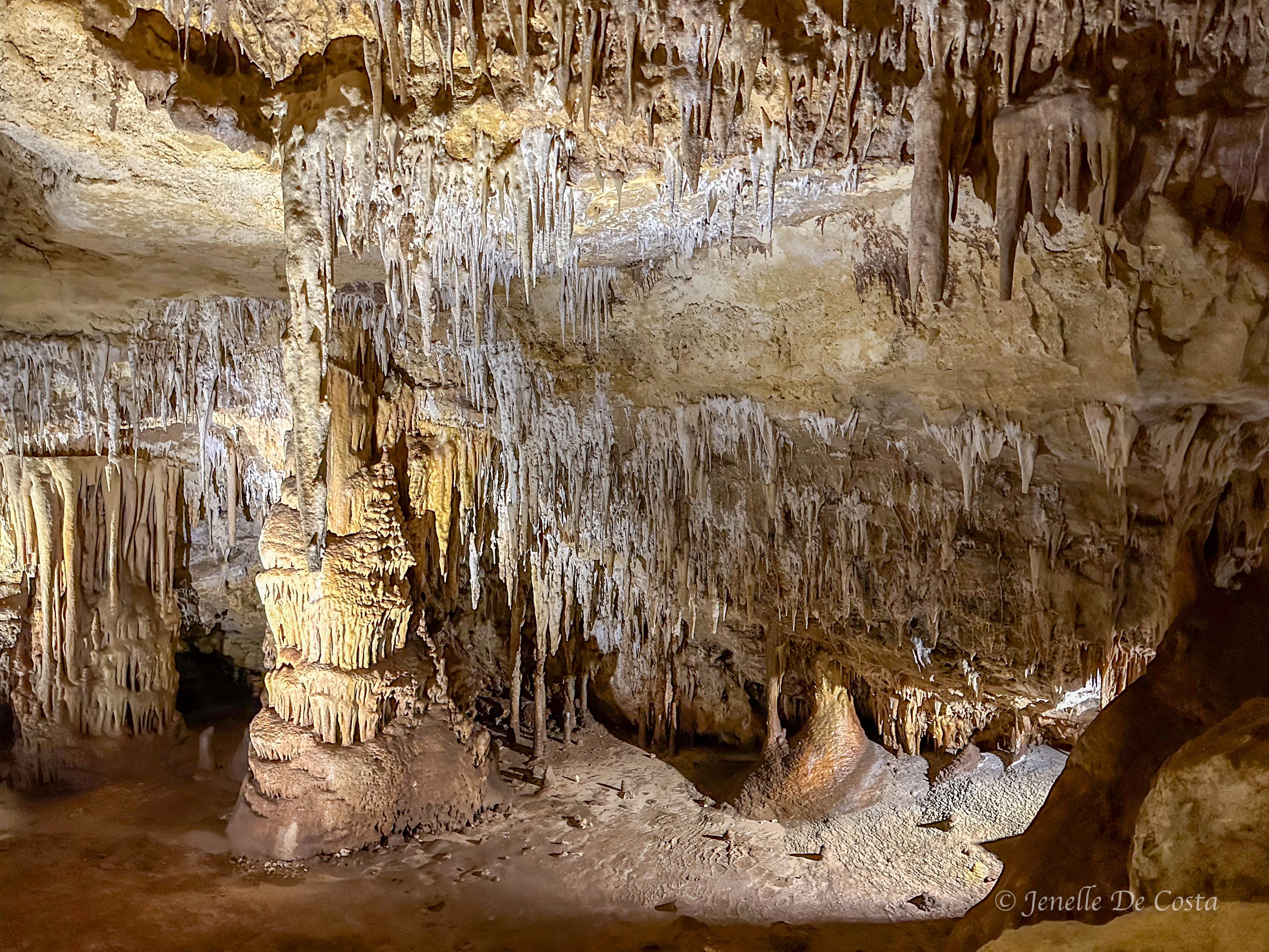
Naracoorte_Caves
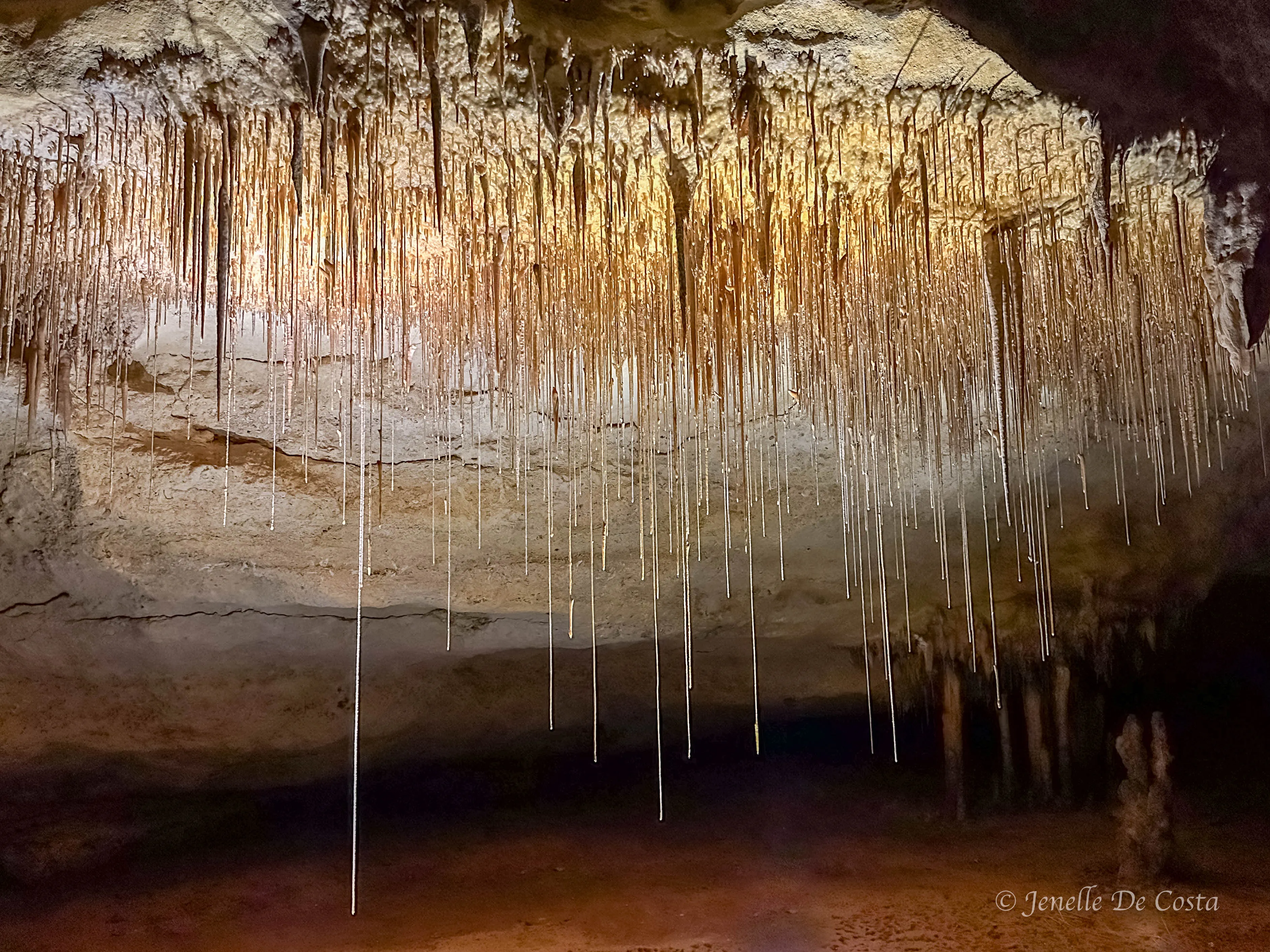
Naracoorte_Caves
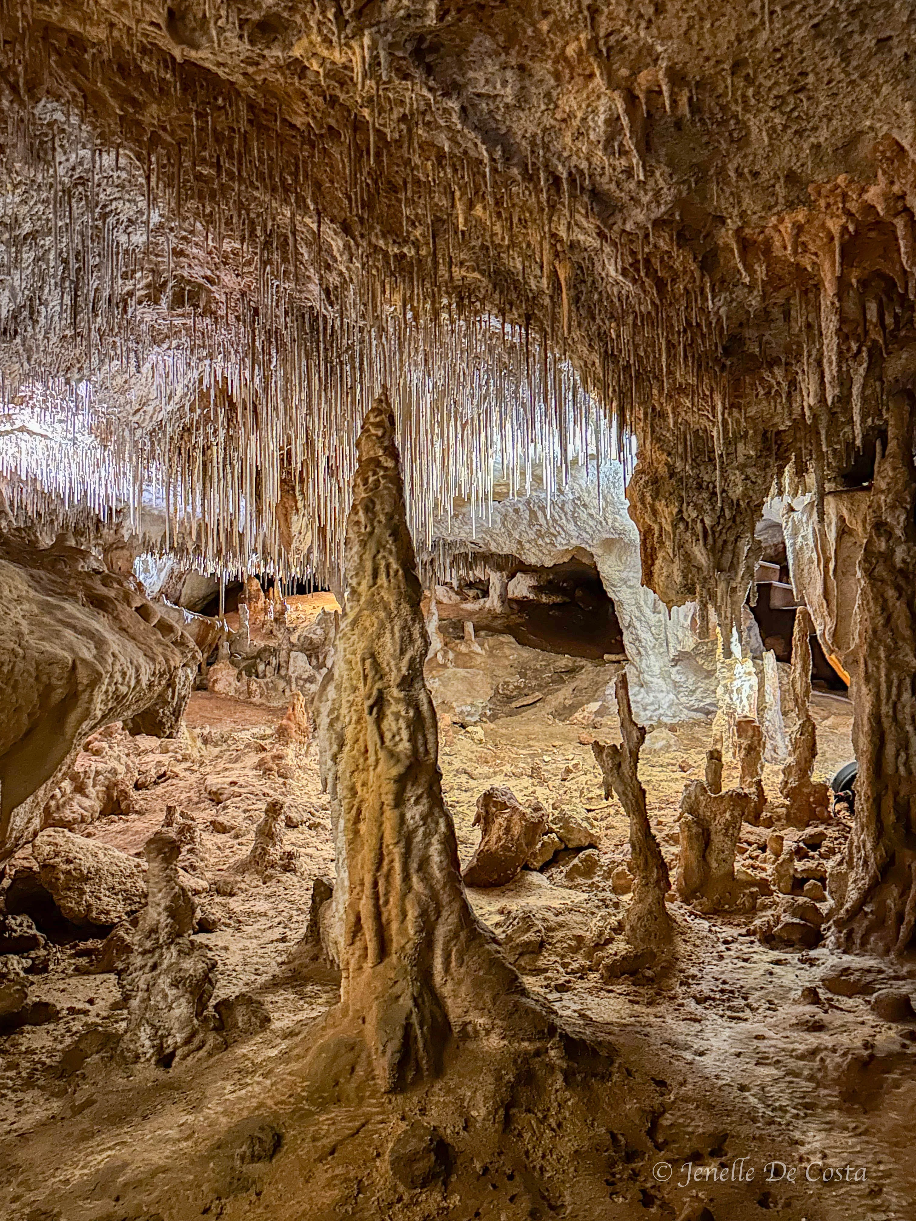
Naracoorte_Caves…mind blown
Above ground again and onto Mt Gambier...
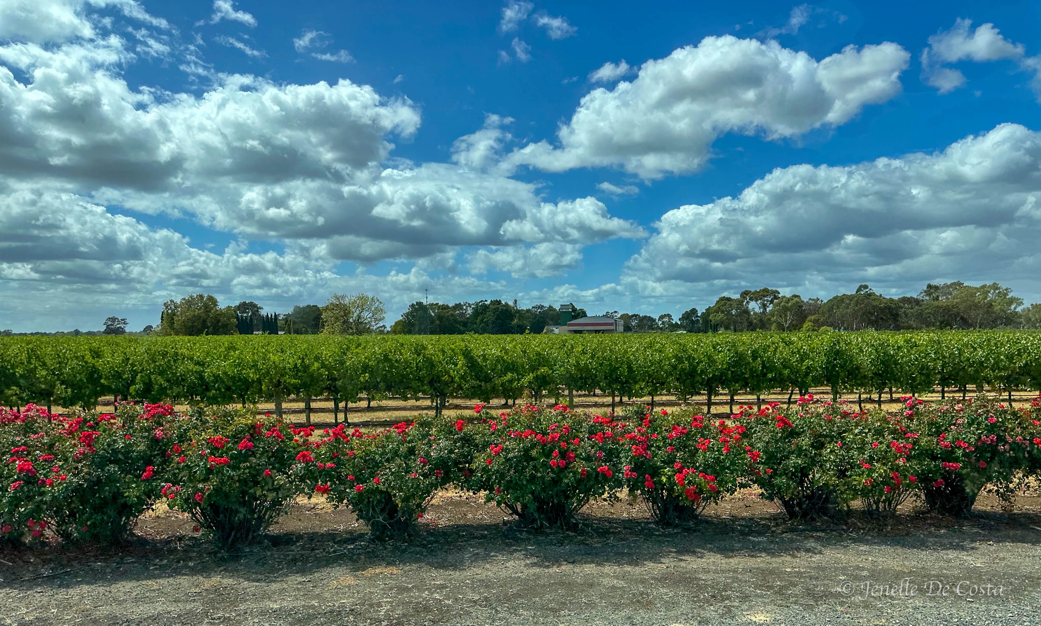
Back to vineyards and roses in the Coonawarra region just north of Mt Gambier
We skipped Mt Gambier sightseeing and head south to the coast at Port Macdonell and the nearby Cape Northumberland...
Cape Northumberland - Camel Rock
Camel Rock - from this angle it looks like a camel…
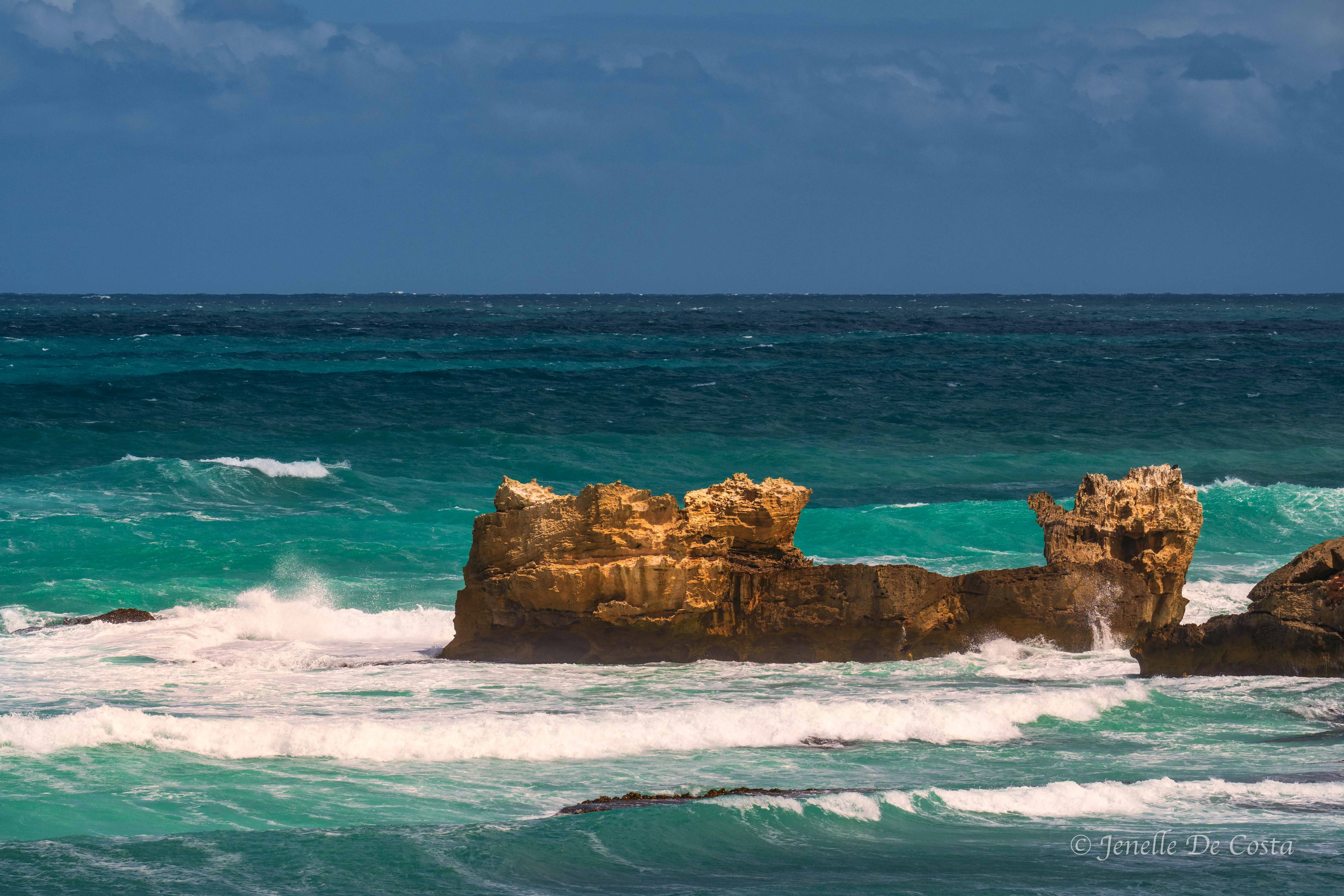
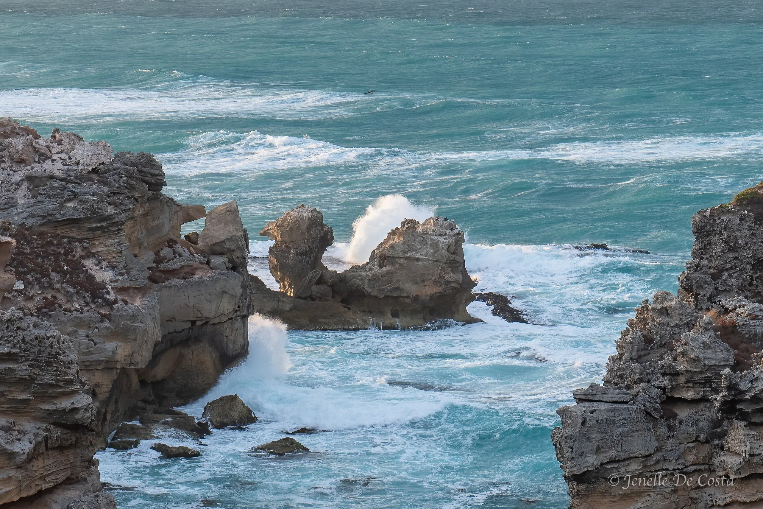
Wild seas at Cape Northumberland…
Day 13 - 16th Feb
Cape Northumberland - Port Macdonnell.
We free camped overnight at Cape Northumberland...
Sunrise at Cape Northumberland…
The craggy limestone cliffs make perfect nesting sites for all manner of birds…
Cormorant gathering nesting material
Cormorants nesting on the cliffs…
Ditto…
Seals hanging out in the back waters of Cape Nothumberland…
After breakfast it was time to check out the sites in and around Mt Gambier...
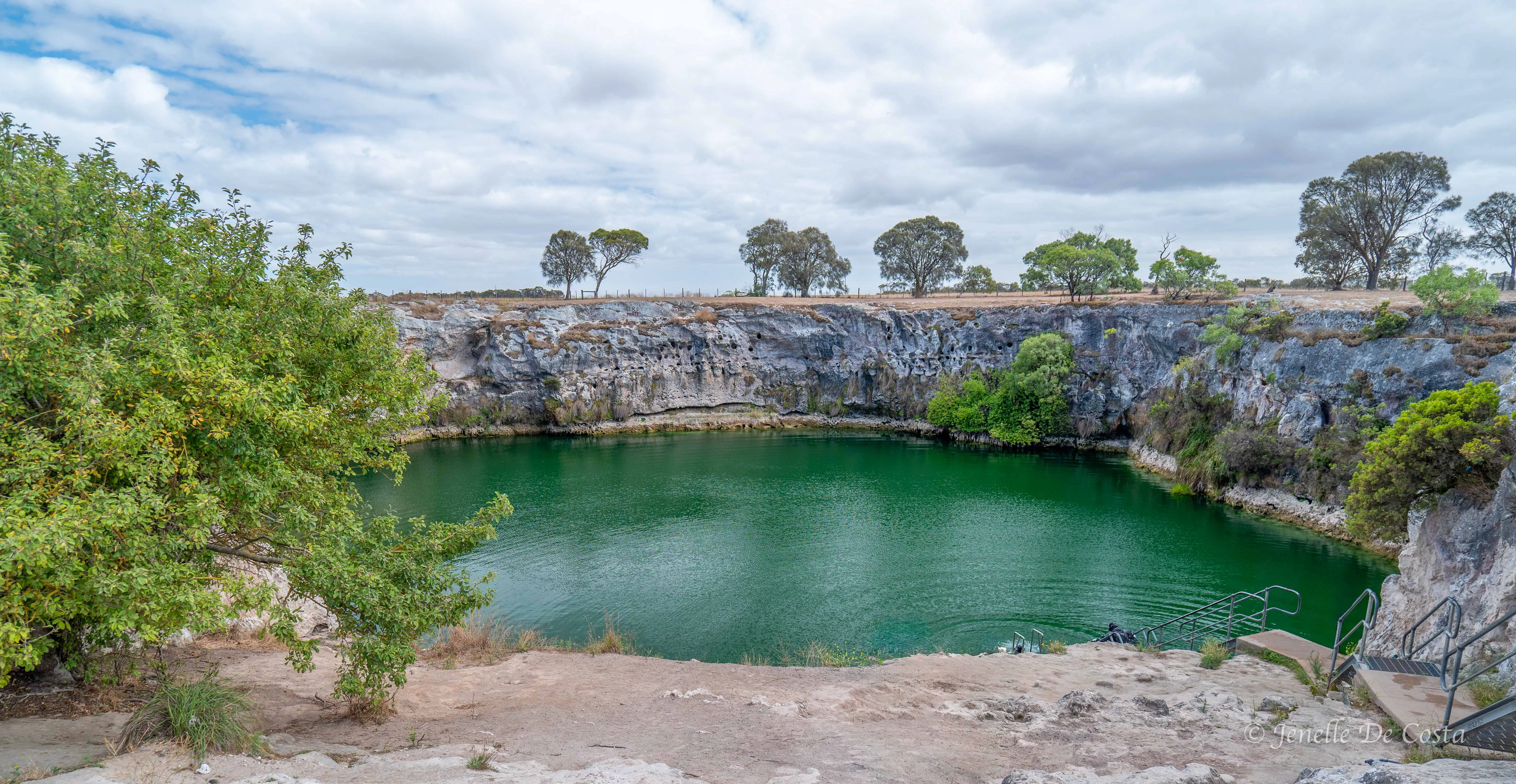
The iconic Blue Lake in the heart of Mt Gambier …
Also in the heart of Mt Gambier is the magnigicant Umpherstone Sinkhole...
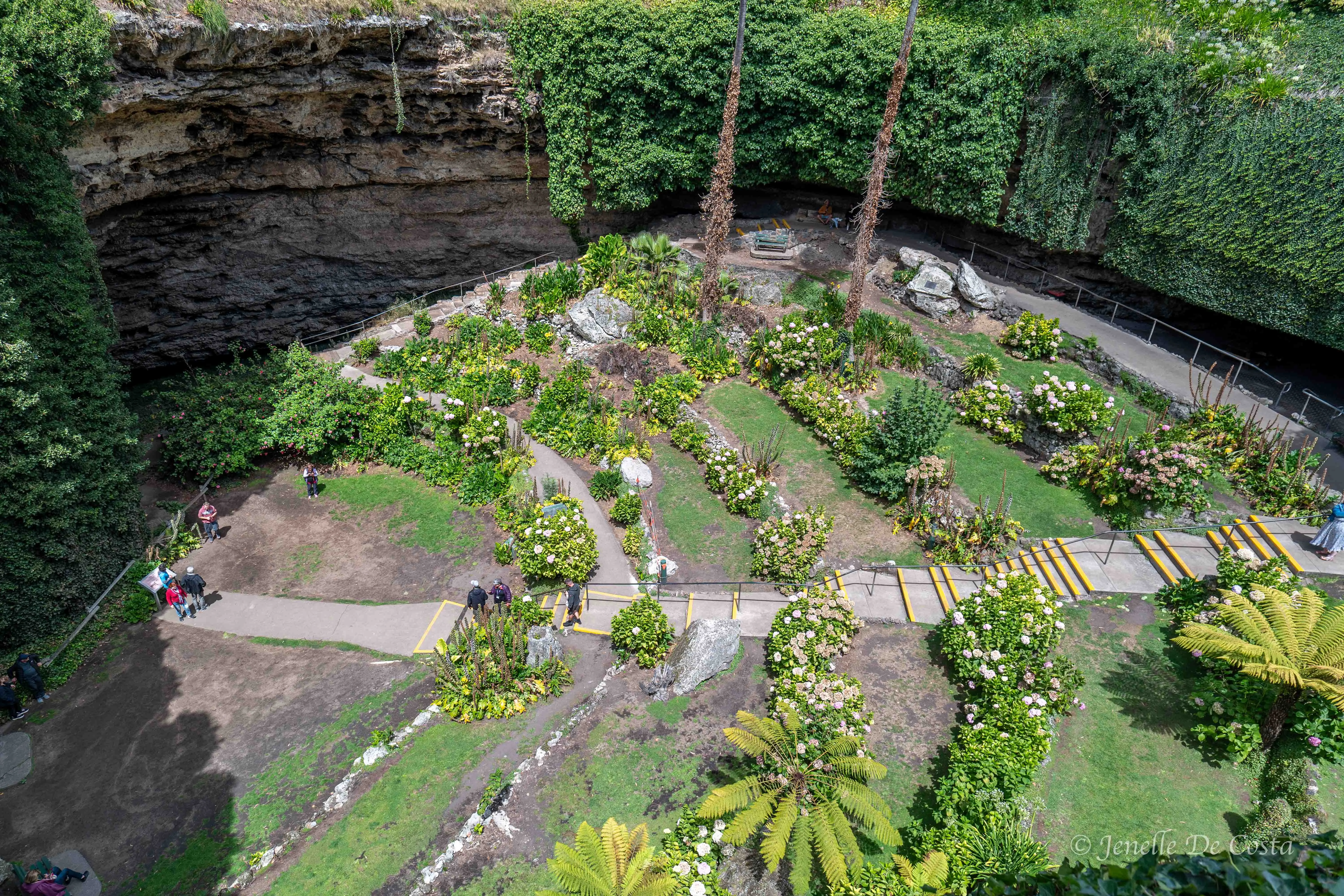
Umpherstone_Sinkhole_Garden…
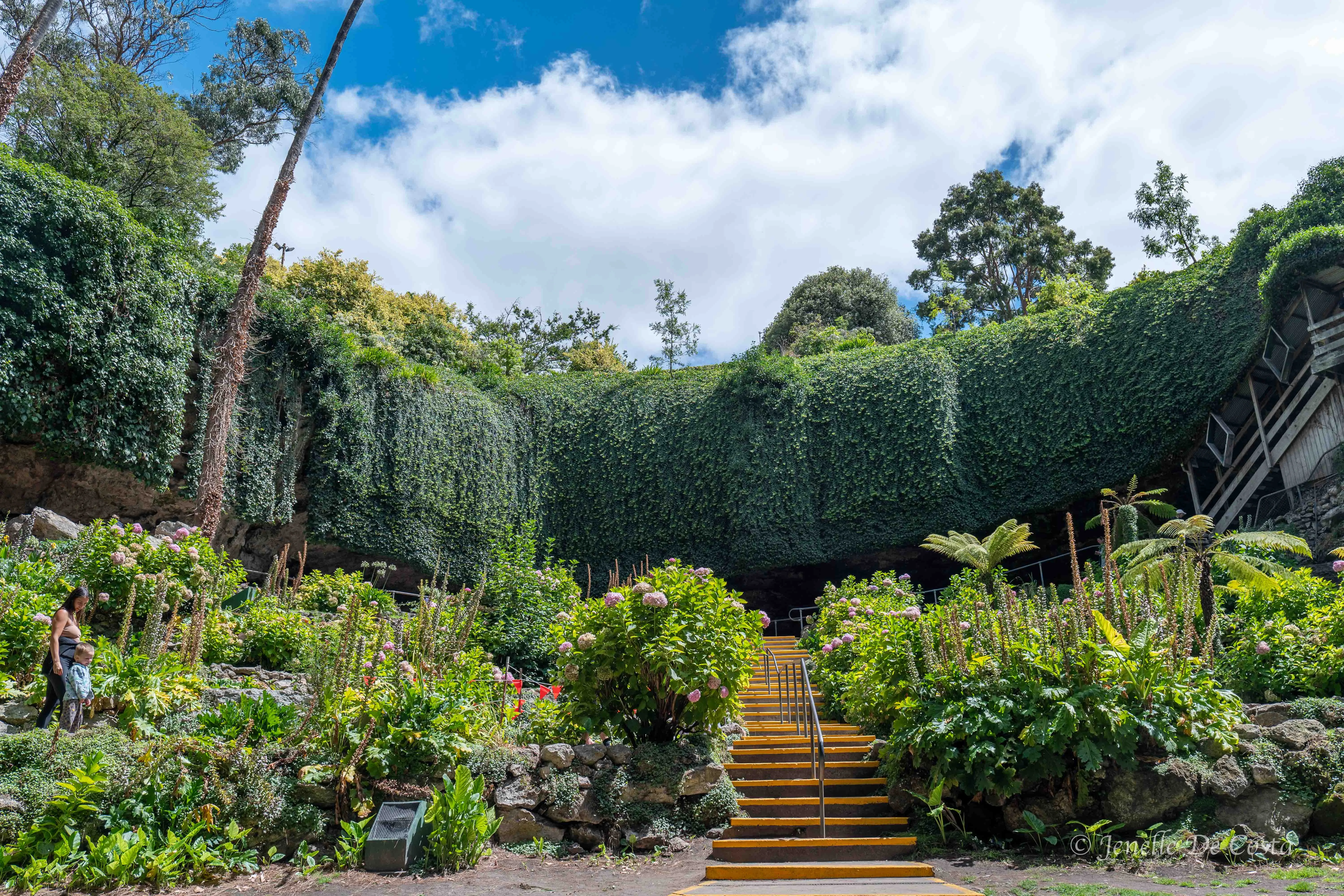
Umpherstone_Sinkhole_Garden…
The Little Blue Lake…
This region, in fact most of coastal SA, is limestone. Sinkholes are formed when the roof of limestone caves collaspe. The Sisters Sinkhole is an excellent example...
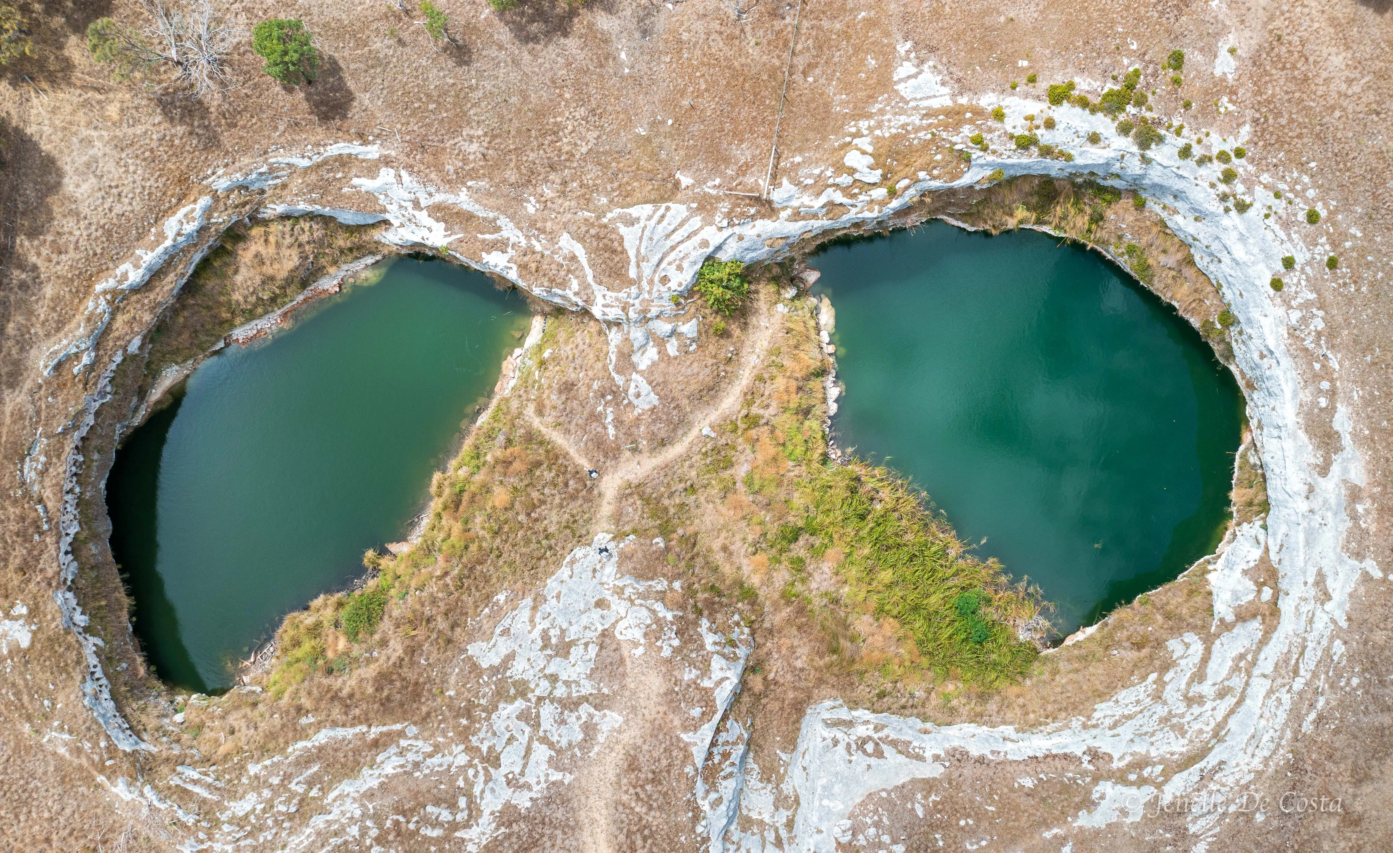
The_Sisters_Sinkhole…
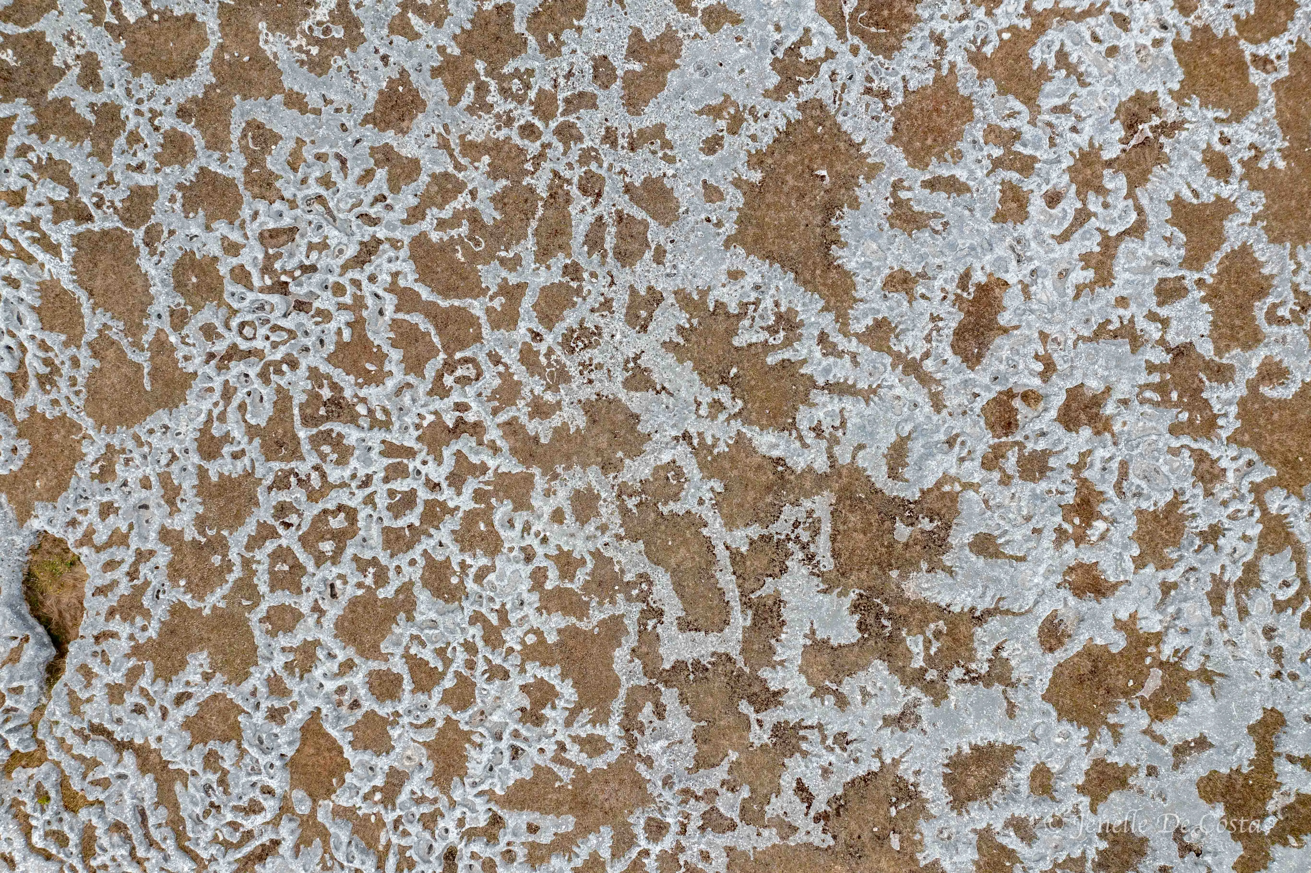
In some places there is barely enough topsoil to cover the underlying limestone rock. From above it looks like lace…
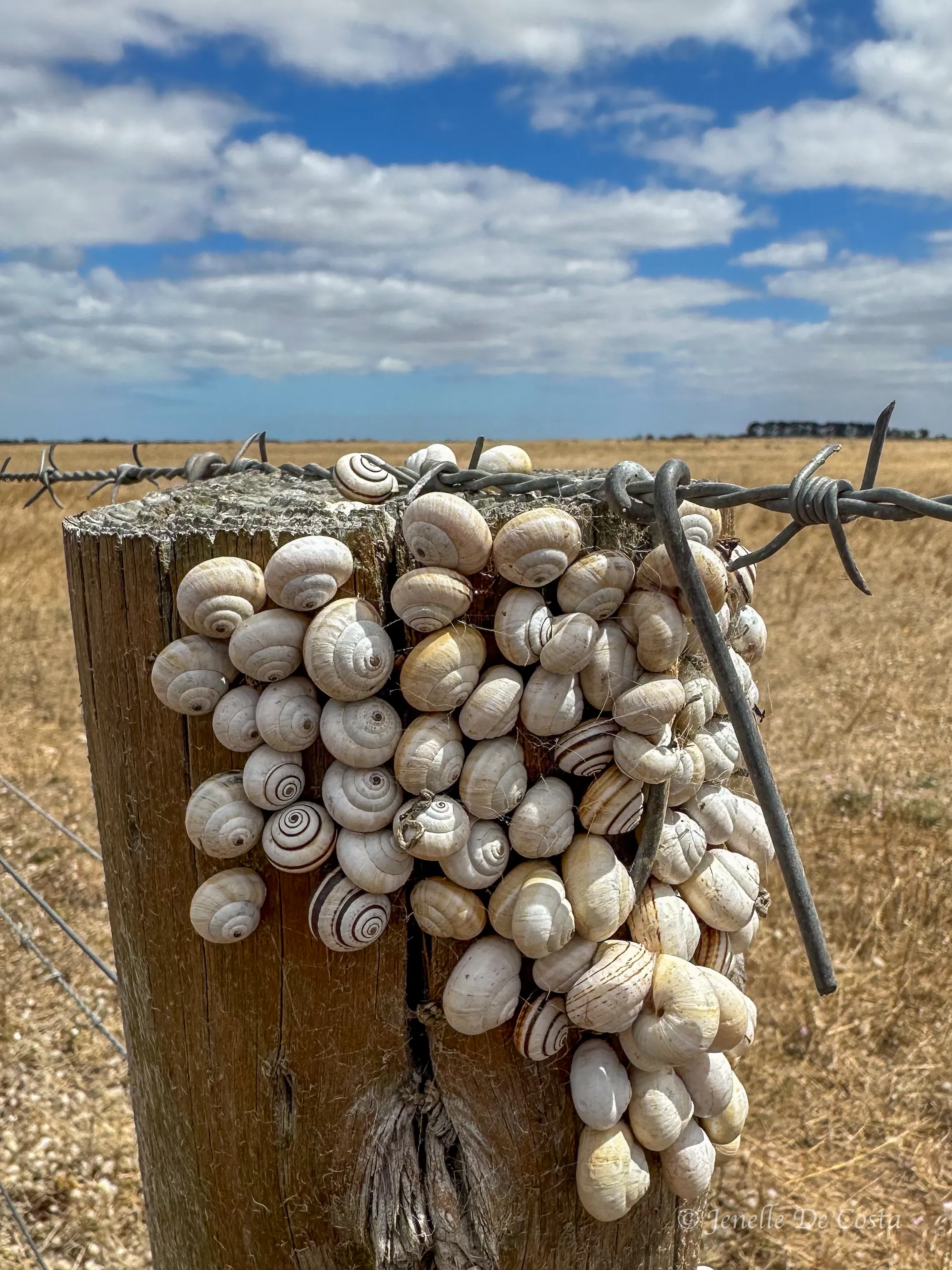
Snail shells cluster at the top of every fence post for miles…
Back to Port Macdonnell from some wonderful fish and chips and overnight at the local caravan park...
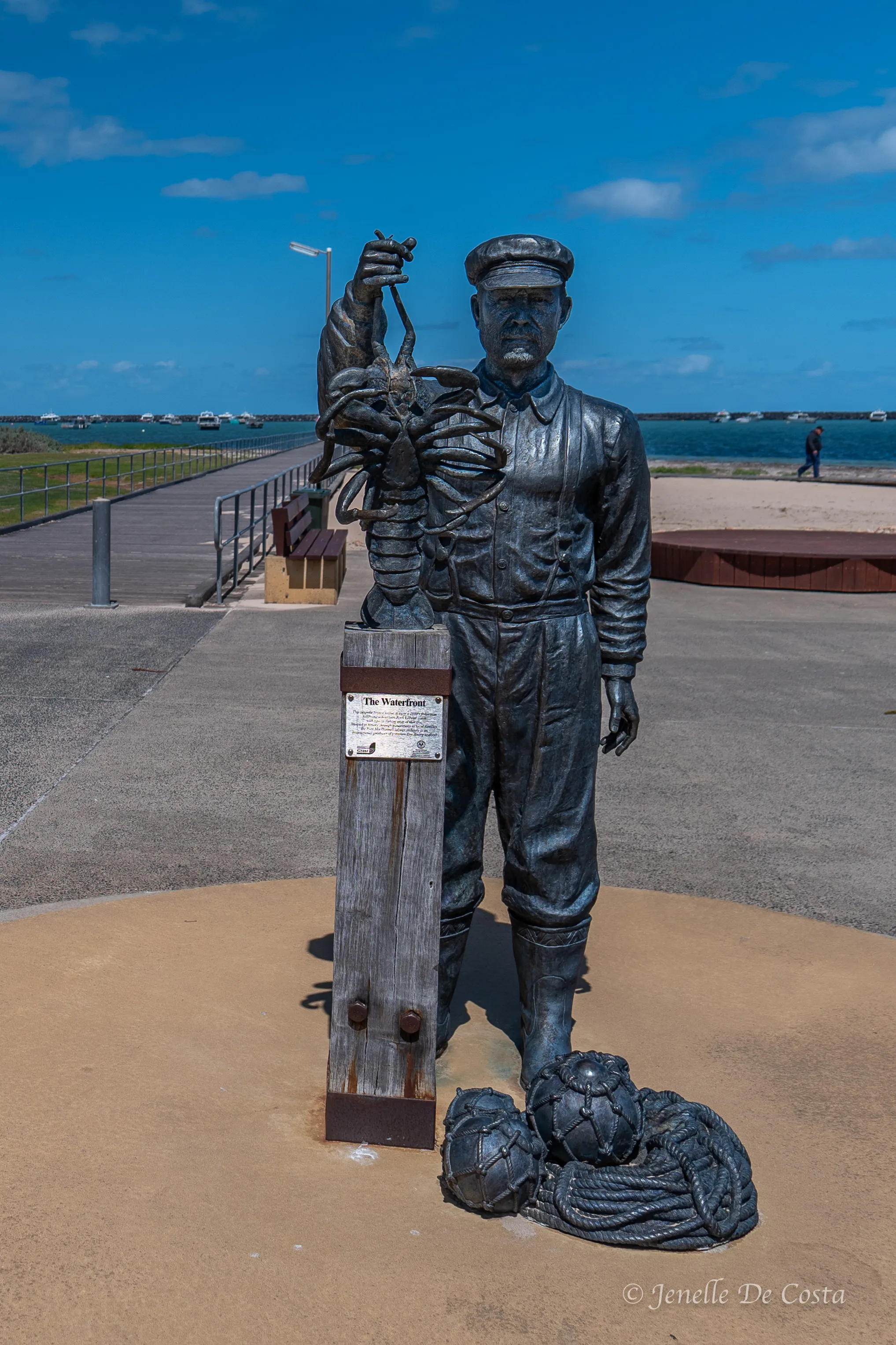
Much of the SA coast are rock lobster fisheries. Port Macdonnell imortalized the fishers…


